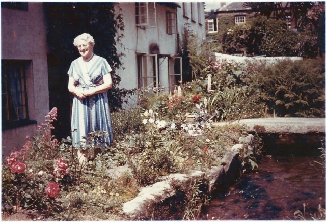
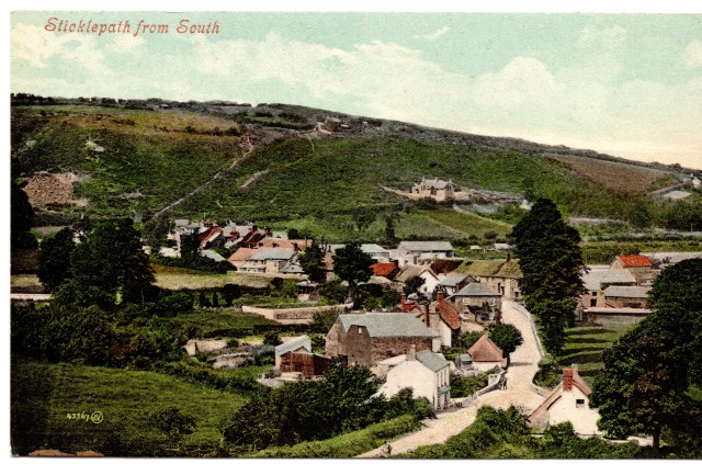
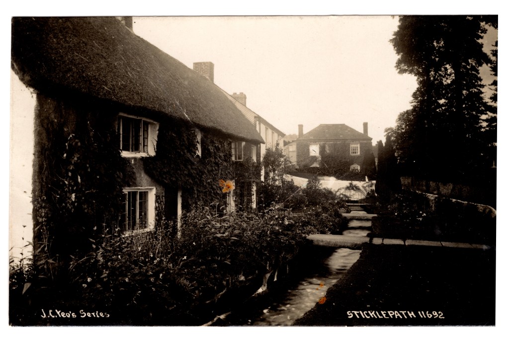
Sticklepath’s leat provided water power to run the mills. Primula House, seen here in the top right corner of the photograph marks the place where the leat moves from behind the houses to the front gardens. Shortly afterwards the water re-joins the Taw River at Sticklepath Bridge. Jessie Barron, nee Finch, is seen here next to the leat in her lovely sunny garden. It looks idyllic. However, several tragedies are associated with this waterway.
Explore the lives of Jessie’s Uncle, Thomas Finch and his family, to discover their tragic story for yourself, using the census and registry office information (birth marriage and death), a newspaper article and some memorial cards.
Researching family history is exciting as we discover records, imagine celebrations and solve mysteries. However it can be frustrating when we can’t find answers, and surviving records often relate to deaths and tragedies. Then our hearts go out to those involved.
Thomas Seacombe Finch was born in 1866 when his brother James was 10, Susan was 6, Jessie (not the one above) was 5 and Albany was 3. In 1871 we find them with their parents George and Rebecca Finch in Primula House. This timeline follows events in their lives:
1872 sister Naomi was born
1881 Census – Thomas age 15 is living in Primula House with his parents
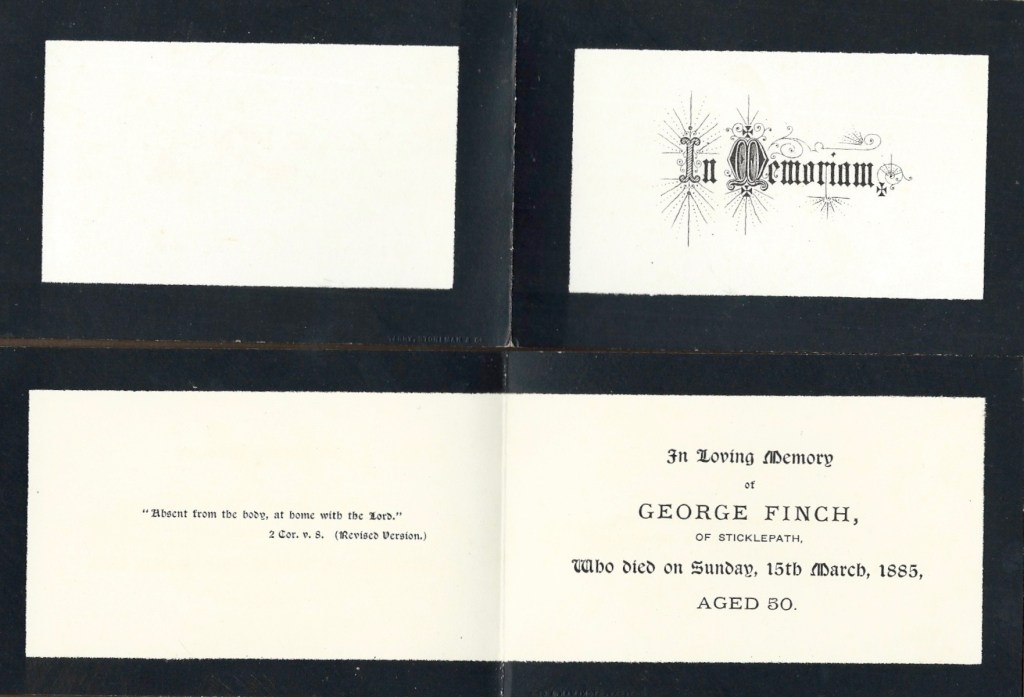
1885 father George died
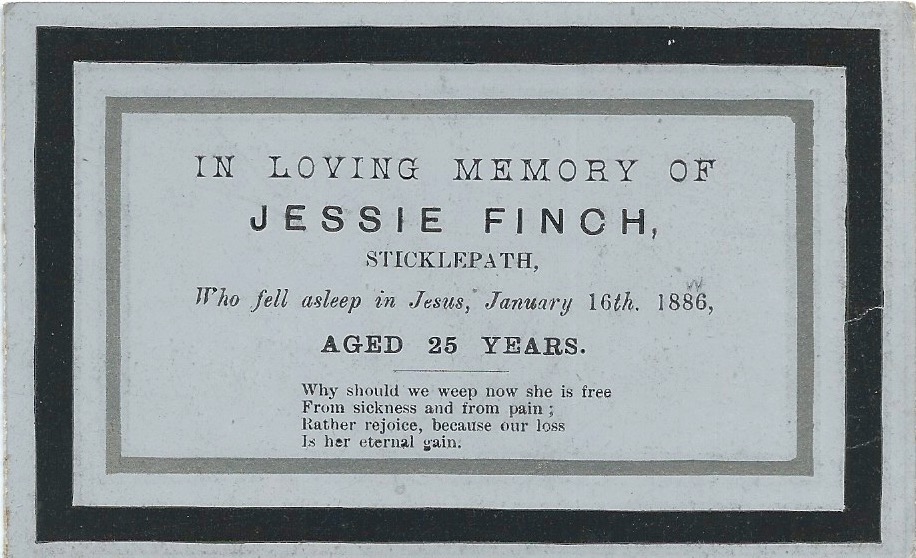
1886 sister Jessie died
1891 Census – Thomas is still living in Primula House
George Finch, aged only 50, took ill fairly suddenly and died. The family understood he had toothache, the doctor prescribed opium, and he died seemingly of an overdose. The death certificate tells a different story, which need not concern us here. Even today, with all our scientific advances there are often inconsistencies and unanswered questions surrounding a death. Were people more accepting in the past? I wonder.
Ten months later Jessie died of tuberculosis. TB was a common cause of death in young adults at the time. Often people became pale, weak and lost weight, giving it the name ‘consumption’. Coughing up blood was often a late sign of pulmonary TB. There was no cure.
Happier days followed. I have no idea how Thomas met Essex girl Annie but the timeline continues with a marriage certificate, and the birth of a son:
1893 January Thomas Seacombe Finch married Annie Lena Locking in Essex
1893 December Victor Thomas Finch was born
Victor was healthy, growing well, starting to walk and watch the other children around him with interest. Just when things were going well, totally out of the blue, tragedy struck. 2 months before his 2nd birthday Victor died.
An unexpected death means a coroner’s inquest. These were often held in the local pub. Coroner’s records often do not survive or are not accessible, but the newspaper reports are fairly detailed. The Western Times of Friday 25th October 1895 (accessed from http://britishnewspaperarchive.co.uk January 2021) tells us:
Child Drowned at Sticklepath
Mr Coroner Prickman held an inquest at the Taw River Hotel, Sticklepath, on Wednesday, on the body of Victor Finch, aged one year and ten months, who was drowned in the Taw River on Monday. Mary Ann Cooper, of South Zeal, said she saw the deceased playing with some other children in the garden adjoining the mill leat. The water in the leat is about a foot deep and the bank about five feet high. Thomas Finch, blacksmith, of Stickelpath, said the deceased was his only child. He went into the garden to fetch his child to dinner, and found him lying in the river quite dead. The other children who were playing with the deceased were too young to give evidence. Dr Middlemist, of Okehamptnn, said he considered the child was stunned by the fall. Accidental drowning was the verdict. (Transcription includes spelling errors as printed).
Reflecting on the story, shows how times have changed. A group of young children, of different parents, would not be left completely unsupervised in a garden, especially not with an unguarded 5 foot drop and a stream running through. Even the smallest ponds tend to be covered or filled in. No hint of blame or reprimand was mentioned. I wonder how much shame or guilt would have been felt? On the other hand, perhaps our children lose something by not being allowed to play freely outside, albeit in a safer environment.
“The only and Dearly-loved Child of Thomas and Annie Finch” – their grief is almost palpable.
This newspaper gave a relatively sanitised version of the story. Another paper clarifies that the body was indeed found in the river, not the leat, having presumably been swept along by the water almost to the bridge. We can picture the rising panic, hunting for the toddler, before the dreadful truth is discovered. Very distressing.
A couple of years later, happier times follow:
1897 daughter Gladys Lena Finch born
1900 son Leslie George Finch born
1901 census Thomas, who describes himself as a farmer, is living with family, a domestic servant aged 17 and brother-in-law Stephen Locking is staying.
(You could only put one occupation on the 1901 census. Thomas was one of the three Finch Brothers running the Finch Foundry or smithy at the time, but he took the lead for the farming aspects).
COMING SOON: Tragedy strikes this same family again. Part 2 next week!
#OnePlaceStudies Society provides blog prompts for each month during 2021. You don’t have to be a Society member or have a registered One Place study to join in. Everyone is invited. February’s prompt is #OnePlaceTragedies. Further details at https://www.one-place-studies.org/resources/blogging-prompts/
“Landmarks, by their pure existence, structure environments. They form cognitive anchors, markers, or reference points for orientation , wayfinding and communication. They appear in our sketches, in descriptions of meeting points or routes, and as the remarkable objects of an environment in tourist brochures.” (Richter and Winter)
Landmarks are often visible from a distance, or are features which, for a traveller passing through, mark One Place as different to another. I would add to that: ‘scars’, symbols or indicators in the environment which point to the history of our place.
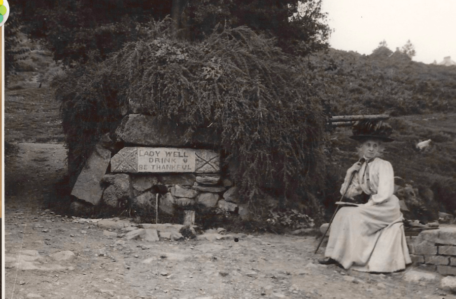
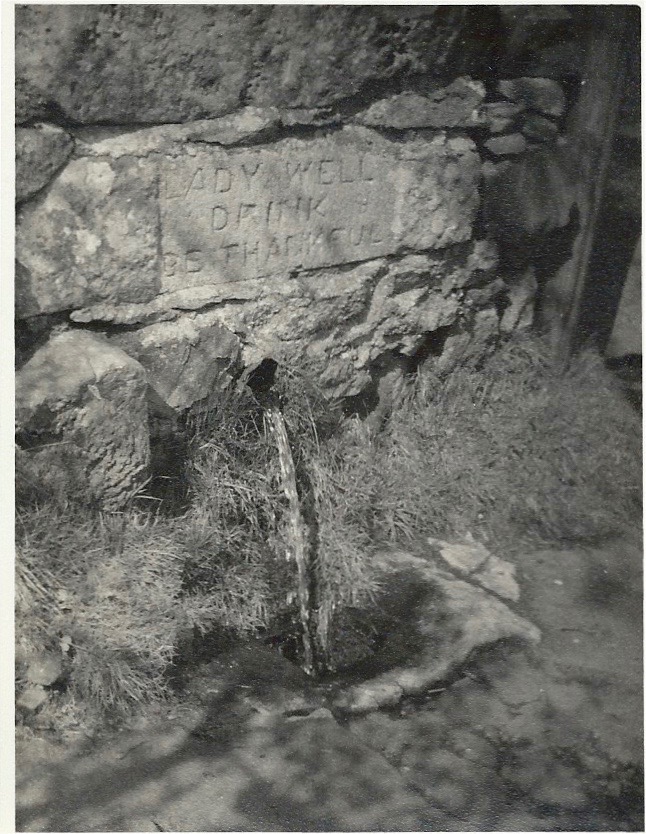
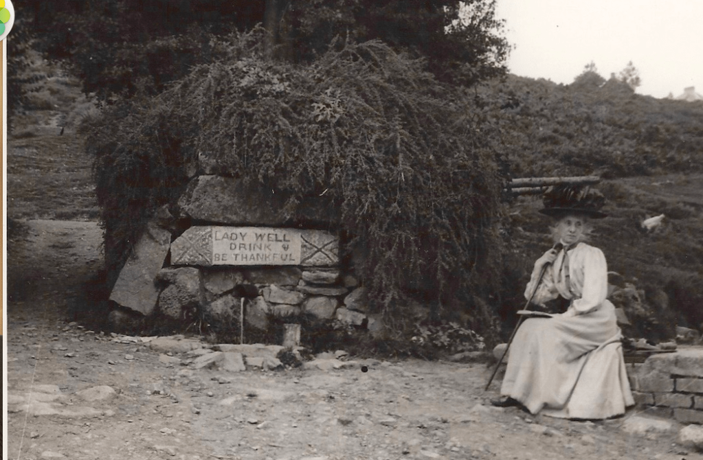
“Lady Well Drink & Be Thankful” 1900-1910. Mrs Elderton of Laurel Cottage/Staplers. (Notice the standing stone to the right hand side, at about the same level as the top of her hat. Note the crosses marked on the Lintel either side of the inscription.)
Ladywell is mentioned in tourist information about Sticklepath, it represents both a physical landmark and landmark in history, before piped drinking water came down the street or into our houses. I surmise Ladywell would also have been an important social gathering point where people exchanged news whilst waiting to fill their containers. (Long before lock down, so no evidence of 2m marks!)
1920s
It is not clear where the lintel stone came from. The crosses seen on it in early photographs have eroded considerably.
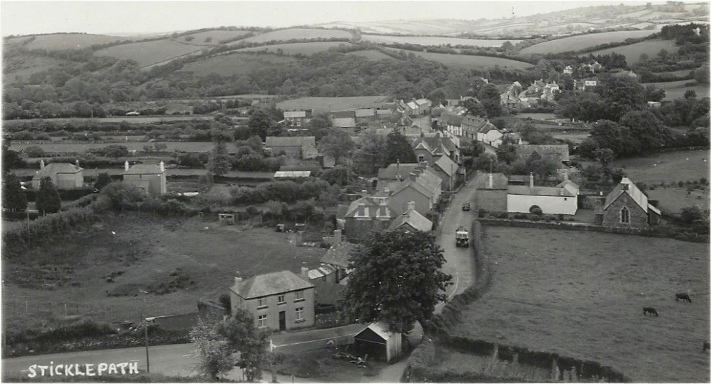
First let’s orientate ourselves using some other landmarks. As you travel through the village towards Okehampton and Cornwall, look past the small St Mary’s Church to see Ladywell on the left. Just there, by the roadside, as you start to notice the rise of the hill under your feet, with ‘White Rock’ and its flagpole on the Mount above.
The tree and building are long gone, but find a pleasing bench on which to rest your weary legs, admire the village scene and ‘Be Thankful’. Probably not wise to drink!
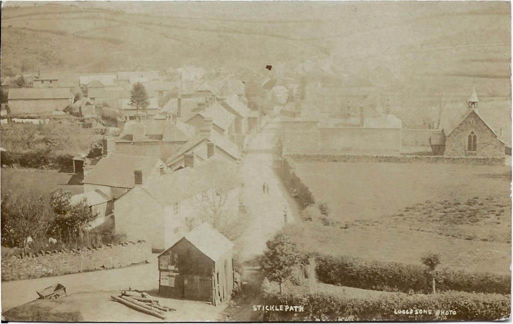
Ladywell to right of centre below the tree, where the children stand. Shame we missed the horses… Above are White Rock and flag pole, and to the left the bare rock of the quarry can be seen. Chapman postcard
In about 1820 John Pearse, wool-stapler from Cleave Mill, had the overflow from Ladywell spring piped to the present Ladywell site, for the convenience of his Mill workers and the rest of the village. Ladywell much as we see it was built in 1831 – 2 yrs after the road was widened. A concealed pipe leads to a tank hidden beneath granite blocks and from there runs out through the short pipe we see, beneath the engraved lintel, ready to fill containers, to quench a thirst and flush the roadside drains.
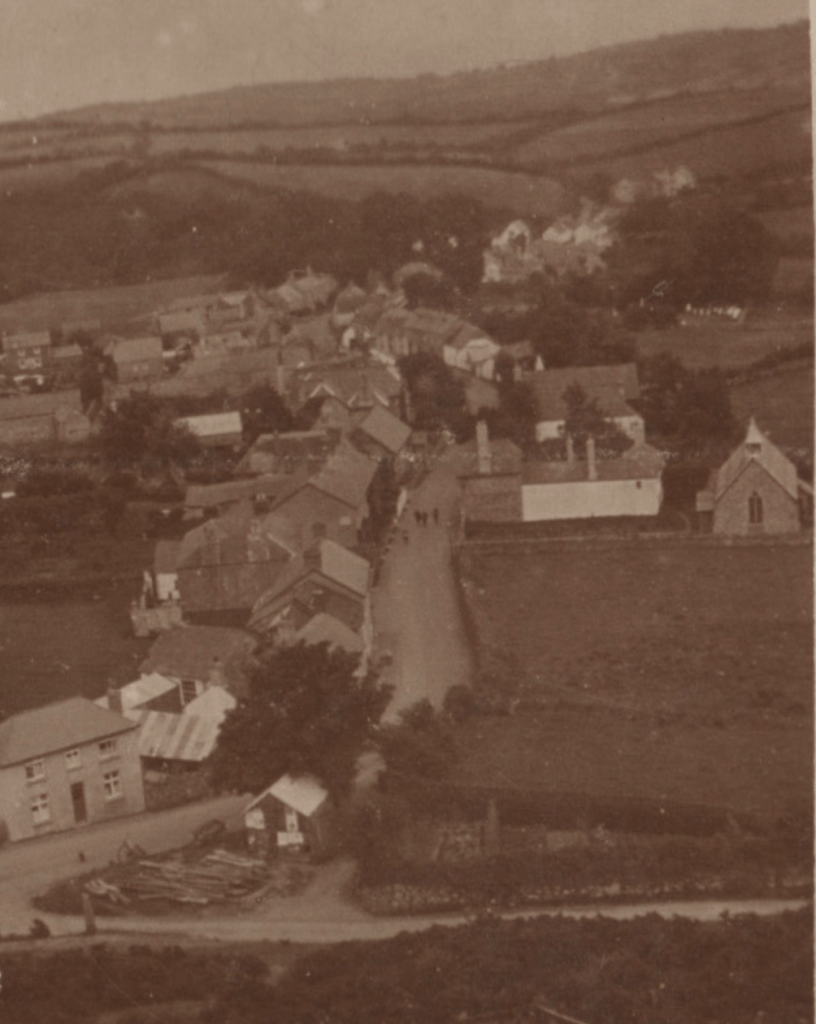
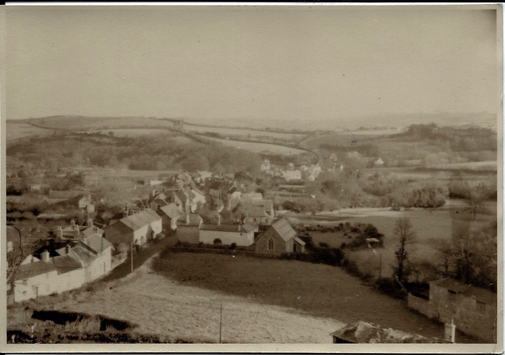
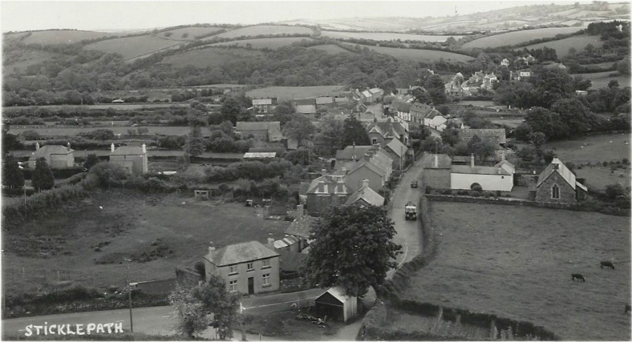
Looking down from the Mount near White Rock, Sticklepath is laid out before us. The dark tree marks Ladywell, bottom left, and can see St Mary’s church on the right. (Phyllis Finch Album)
Ladywell Spring
In fact Ladywell spring, essentially a round well 2 ½ – 3 feet diameter and perhaps 4-5 feet deep, is towards the top corner of a field known as Allermead, further up the hill on the opposite side of the road (see photo below for indication of where it is),
There has been some suggestion that this was a ‘Holy Well’ and that the origin of Allermead could be essentially ‘Hallowed meadow’. I am not aware of anything to support this but being close to the church it is possible it was at one time part of the incumbent priest’s lands.
If we could pan left, just out of shot, towards the far corner of that field (known as Alder Meadow or Allermead) we would find the spring that supplies Ladywell. Imagine now we can take our camera and pan across to the right –
Looking in the bottom right corner of the photo we see the start of some buildings…
These are Pearse’s Cleave Mill buildings. (Photo about 1960?)
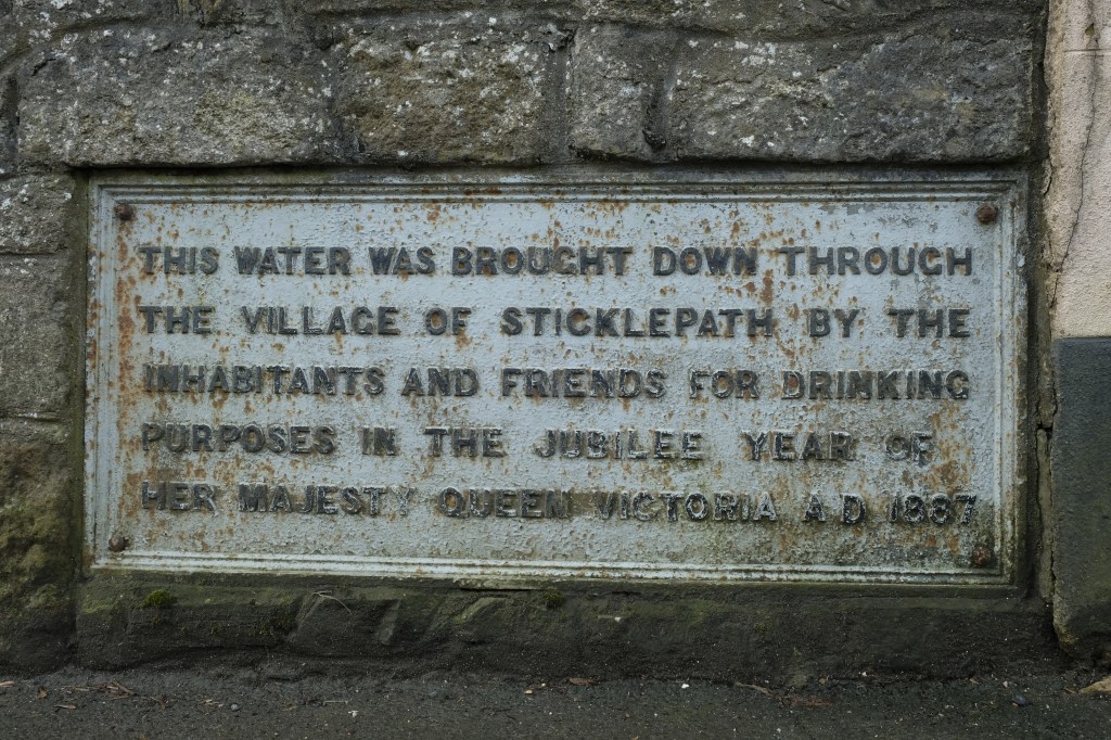
In 1887, the villagers arranged for the Ladywell water to be piped down the village street. This is commemorated on a plaque on the wall next to the chapel. (The wall was taken down and rebuilt with the plaque re-installed, when the road was widened). Being almost ‘outside’ the Parish, certainly not the main focus of Parish affairs, Sticklepath arranged many projects like this one without input from the Parish, relying on locals and wealthier well-wishers.
The wording suggests a standpipe would have been next to or below the plaque. I think a stand pipe is visible on this photo, below the plaque. Before the road was widened.
Jessie Barron tells us more in her book. Referring to living conditions following the 2nd world war she says:
Her final sentence a timely reminder of the infection free, quality monitored, piped water we all take for granted, but which was a luxury innovation for our grandparents generation.
Dartmoor water whilst commonly considered ‘natural and pure’ can be contaminated in various ways, even on open moorland, due to the geology and farming – radon and radioactive carbon contamination, excessively acid and corrosive, high aluminium or other metal content, urine and faecal contamination, decaying matter upstream, and even vehicle pollution, for example.
Before moving on to the delightful subject of sewerage and Ladywell’s role, we turn to the building just above Ladywell, the shed in the foreground of Lugg’s photo:.
Photo by Lugg & sons of Okehampton
This substantial building with double ‘garage’ doors, is large enough to house a carriage. We can see posters on the lefthand side. This building was constructed and owned by wheelwright and carriage builder James Cook, as stated in his will. His workshop is on the lefthand side of the road part way between St Mary’s and Ladywell. The shed must have been demolished when the road was substantially widened and re-modelled here, perhaps in 1960s? We can see wood and a small cart on this photo. On photos further above there are wheels seen too around the shed.
Extract from the Will and 3 codicils of James Cook this final codicil dated 22 Jun 1918. He died 15 Oct 1918. Probate granted 11 Apr 1919 to Son William Gilley Cook of Shilston Farm, Throwleigh.
Sanitation – A sewerage system of a reasonable standard came much later than piped water. Until then the Well was the means of flushing away household waste through the open drains on the North side of the road. Ladywell overflow ran into a ‘tip-tank’ beneath an iron grating. This was later replaced with a siphon mechanism. Waste from houses on the South side, however, just joined the leat water. Despite knowing this, most villagers on the South side freely dipped the leat for uses other than drinking, as it flowed just by their back doorsteps. Permission to use the leat water was written into most of their contracts.
In the middle of the 17th century the whole village and surrounding lands including mills and therefore the leat supplying them with power, was in the ownership of the Lethbridge family. By the late 18th century most was owned by the Underhill family. Conveyance of the Western and Carnall Mills (Eastern end of the village just by the bridge) from Richard Underhill to George Underhill includes permission to use the leat water for up to one hour a day to water Mill Meadow, and for him and the tenants of adjoining properties to use the leat water to wash their wool on payment of 6 pence per year. The leat itself and access to it remained the property of the mill owners. (Barron). However, they and I think Cleave Mill also, had to give one hour’s notice of wool washing to the Mills lower downstream.
The W.I.’s ‘The Book of Sticklepath (Dartmoor)’ in 1955 commented that not everyone had running water to their home yet:
“Some of the modern inhabitants of the village do the same today, leaving a pail or pitcher to fill under the steady trickle while they ‘run down the village’. ”
The village school which opened in 1879 is higher up the hill than Ladywell. This caused problems for water supply and sanitation. All drinking water was carried up the hill to school. In 1938 a Ministry of Health Inspector wrote
“The water has to be carried an unreasonable distance and I recommend that this matter is given urgent attention” (Hutchison)
It wasn’t until 1952 that a pump was installed to take water up the hill to the school. School toilets could be flushed using rainwater from holding tanks above the playground, as long as it had rained and was not frozen. These tanks were only disposed of in 1970 (the year I left the school!). There were times the tanks had to be filled, for example by Okehampton Fire Brigade during summer droughts, or by a Water Board Tanker during the freeze of winter 1960-61.
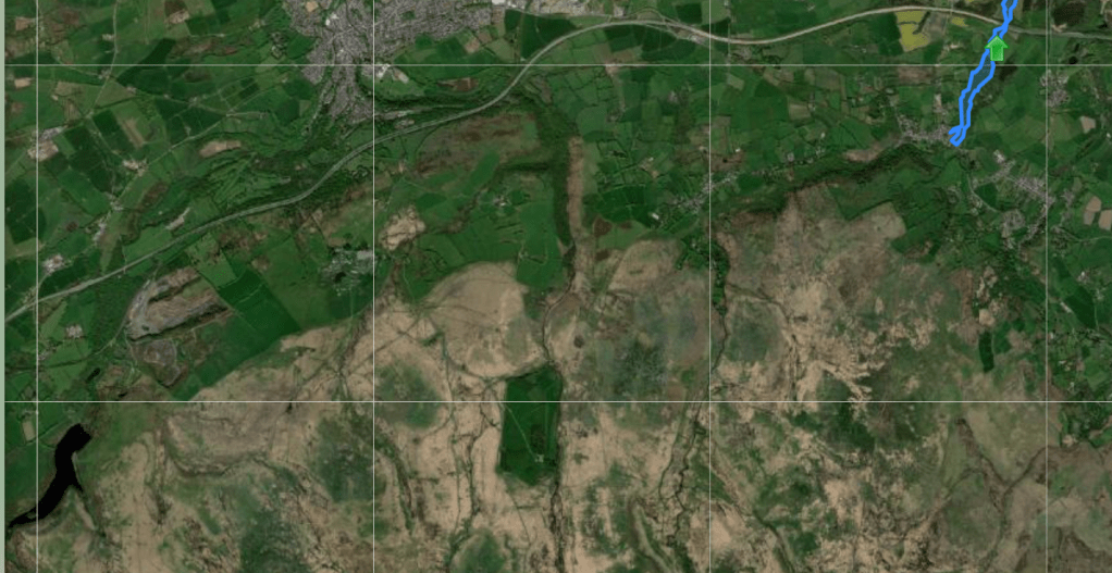
The main supply for Sticklepath village now, along with Belstone’s, is pumped from Meldon Reservoir, about 7 miles away. (I remember visiting the valley before construction of the damn began in 1970, and several times since).
Meldon reservoir far left bottom corner. Sticklepath top right.This aerial view of the same area makes the inhospitable nature of Dartmoor obvious. Sticklepath at the lower end of the blue marker, the dark water of Meldon reservoir bottom left corner.
2019 shows the water plaque bottom left in the wall next to the Wesleyan Chapel. Ladywell and its bench can just be seen in the distance above the red car driving down the road. On the right, adjacent to the 4th car in, we see the granite porch of the village hall.
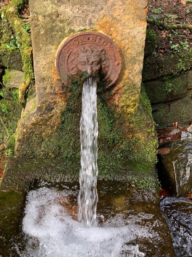
Lion’s Mouth deserves a mention here, purely as a source of drinking water for residents of Skaigh Hamlet, and a pleasing stopping point on a circular walk from Sticklepath Bridge, along the banks of the Taw, through the Skaigh Valley. It likely dates from 1870 in it’s current form.
The Lion’s Mouth, situated not far from the lane leading from Sticklepath up to Skaigh Hamlet and Belstone
Rockside, as it is labelled, otherwise known as Skaigh House, one of the wealthiest estates, at one time owned by Symington who contributed greatly to our village including the building of Sticklepath Village Hall (Next week’s #Sticklepath #OnePlaceLandmark). Again drinking this water is NOT advised, after contamination was found in 2000 by the Environmental Agency.
Additional Notes: 1. Ladywell lends its name to a house on the opposite side of the road but that is not considered here. 2. We should also note residents at the East end of the village used a different spring behind the Taw River Inn in Skaigh Lane. 3. Further photographs of Ladywell can be found in “South Tawton & South Zeal – with Sticklepath – 1000 years beneath the Beacon by Roy and Ursula Radford, pages 26 and 61 – including Chapman postcard no10049, as well as a photograph by Douglas St Leger-Gordon in the WI booklet, those detailed show the position of the standing stone in relation to Ladywell better than those shown above). 4. Water supplies to parts of the village were complicated by being part of, and adjacent to, several parishes. The WI booklet again tells us: “When six ‘council’ bungalows were built down Willey Lane in 1953, pipes for their supply were attached to South Tawton mains, on the other side of the bridge.” 5. Historic England Research Records no 444182 says no evidence was found to substantiate a medieval date for Ladye Well, though the name might suggest a pre-reformation origin. 6. Sticklepath Conservation Area Appraisal suggests a 10th century date for the Ladywell stone, though this may refer to the standing stone rather than the lintel. Conservation Area Appraisal 2017 PDF – http://www.dartmoor.gov.uk. 7. Details of the history of the water supply to Belstone is given in The Book of Belstone (Walpole p131-134) much of which applies to Sticklepath, with various schemes to use Taw Marsh water proposed and some enacted.
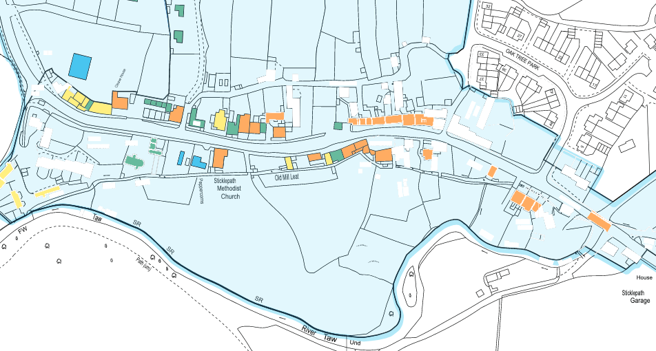
What does one call a collection of landmarks? A Glut? An Album? A Crowd? I have settled on a ‘Tour’ of landmarks, from right to left on the map below. Some will be the focus of a blog, but not all!
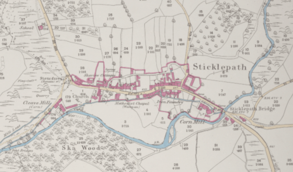
The British Library 25 inch 1841-1952 ℅ The National Library of Scotland website. Many landmarks marked (1886) eg Bridge, cornmill, foundry, chapel, Ska or Skaigh View Cottages, church, stone ‘cross’, flagstaff, quarry, Cleave Mill, mill leat. School also (top left – no image available)
View entering Sticklepath “Western and Carnoll” mills on left side behind white Bridge House, with row of Elm Trees on right, pre-1928 Top left corner quarry below ‘White Rock’ with its flagstaff. School seen half way up the hill to right of midline.
Part of Sticklepath Historic Quality and Integrity map page 19 of Sticklepath Village “Conservation Area Character Appraisal” June 2017 by Dartmoor National Park Authority. Grade II or II* listed buildings and features marked in orange, images below where I can.
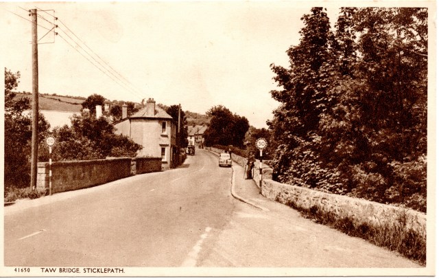
The River Taw flowing under Sticklepath Bridge 1905 approx.
View across the bridge. 1930s?
A plaque commemorating the bridge widening 1928 and old parish boundary stone Sampford Courtenay to South Tawton
Mill House, Taw Leat and Silverlake, (listed). The Monkey Puzzle tree let me know I was home in 1960s.
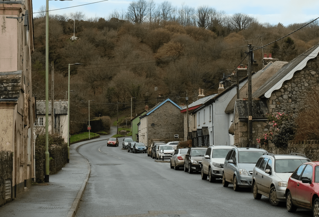
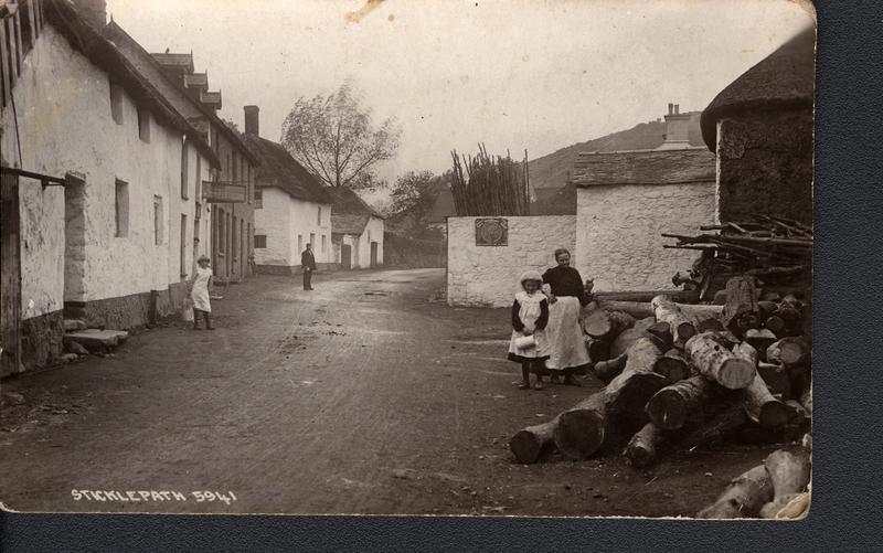
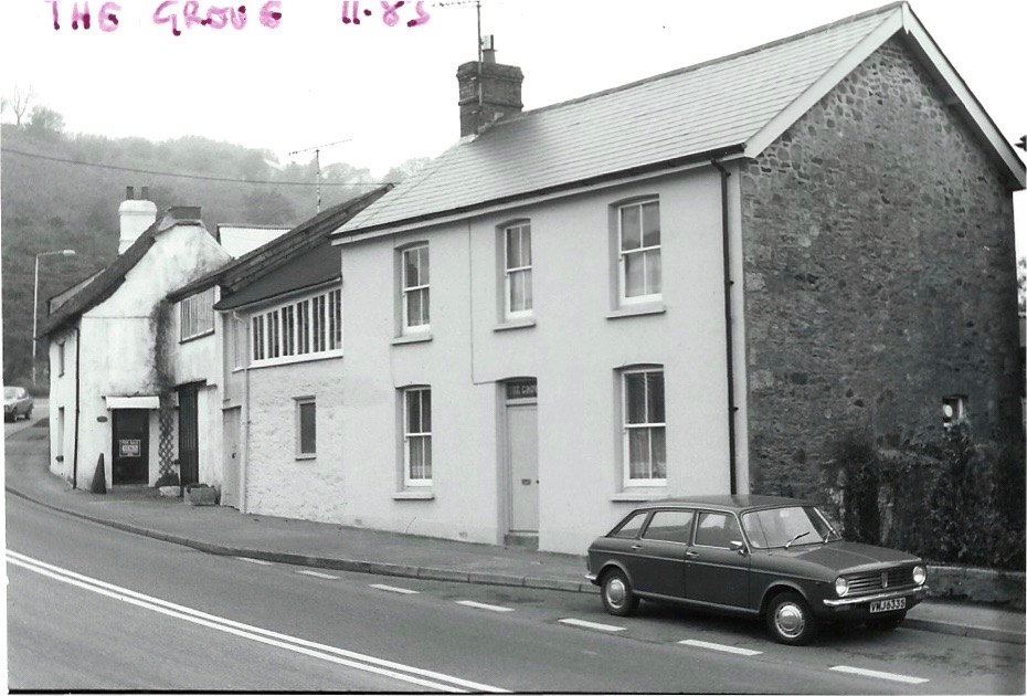
The leat runs uniquely in front of these houses, then to the left of Primula the house facing us and behind all the other houses. Note the large granite slabs forming bridges over the leat. Chapman postcard, I presume commissioned by Yeo of Sticklepath Post Office. 1910s
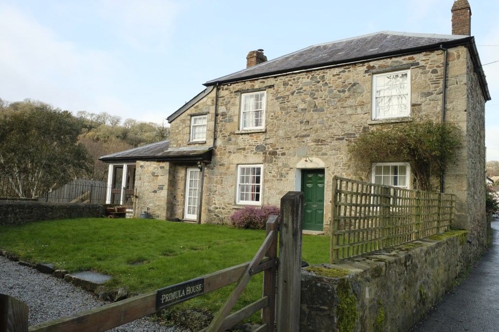
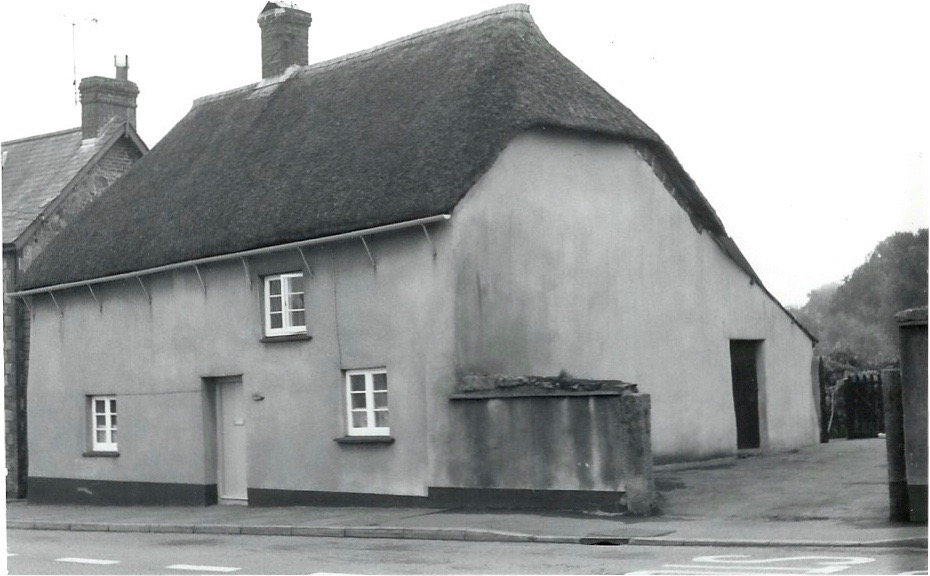
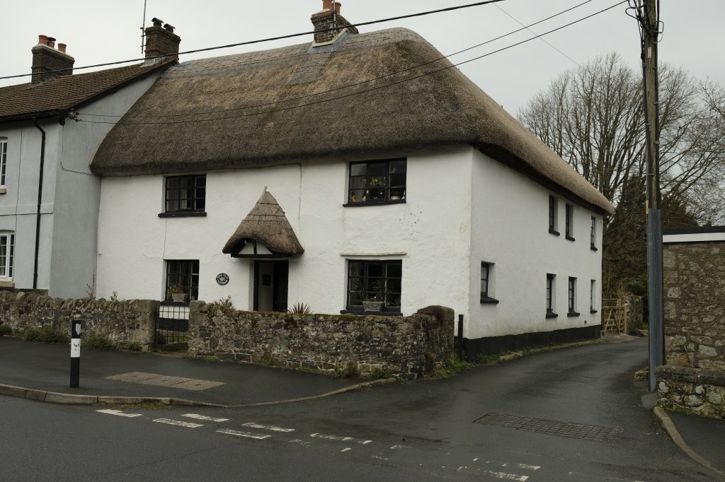
Primula House (Previously Temperence). Inset County ‘C’ stone adjacent to the road. 2019
C stone marking the extent of road maintenance from the bridge by the County, built into side of Primula House (listed)
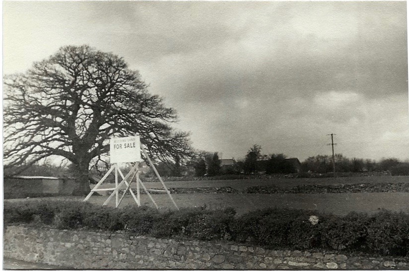
On the opposite side of the road, Oak tree in field for sale in 1970s
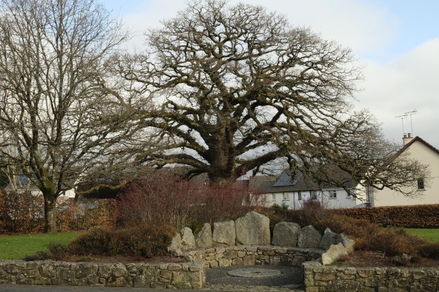
Same oak tree with the Millennium Seat (2000) and Oaktree Park Houses (photo 2019)
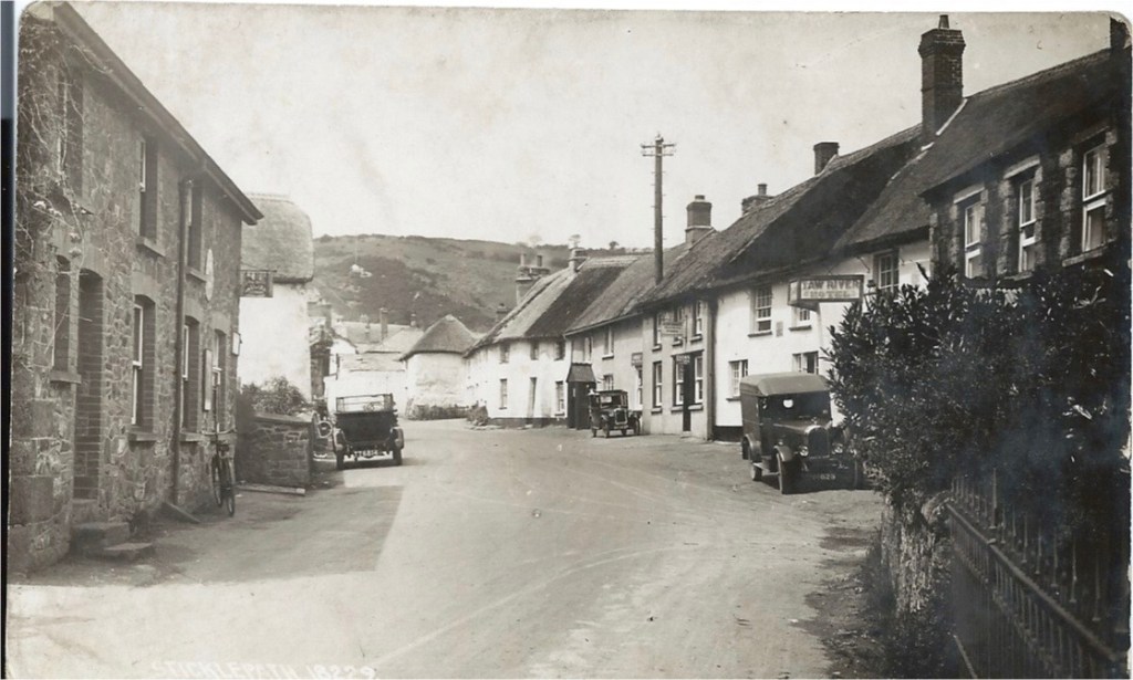
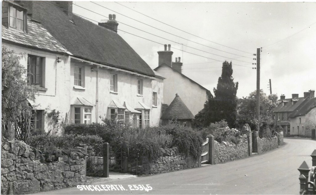
Walking on, the White House on the left was the first post office, then the house on the right by telegraph pole, the two small cottages closer to us on the left took turns being the post office later. Much more recently it moved across the road to the now Village Stores, first building on the right. The Taw River ‘Hotel’ is seen. The black porch marks ‘The Dairy’. The thatched square white building protruding in the distance is where the candle factory was.
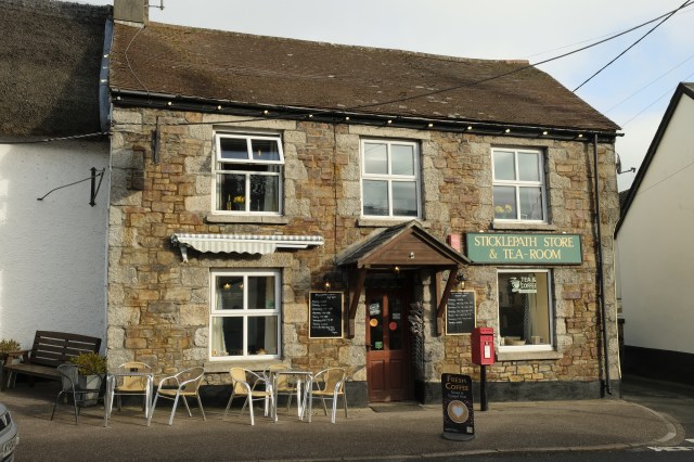
Village shop 2019
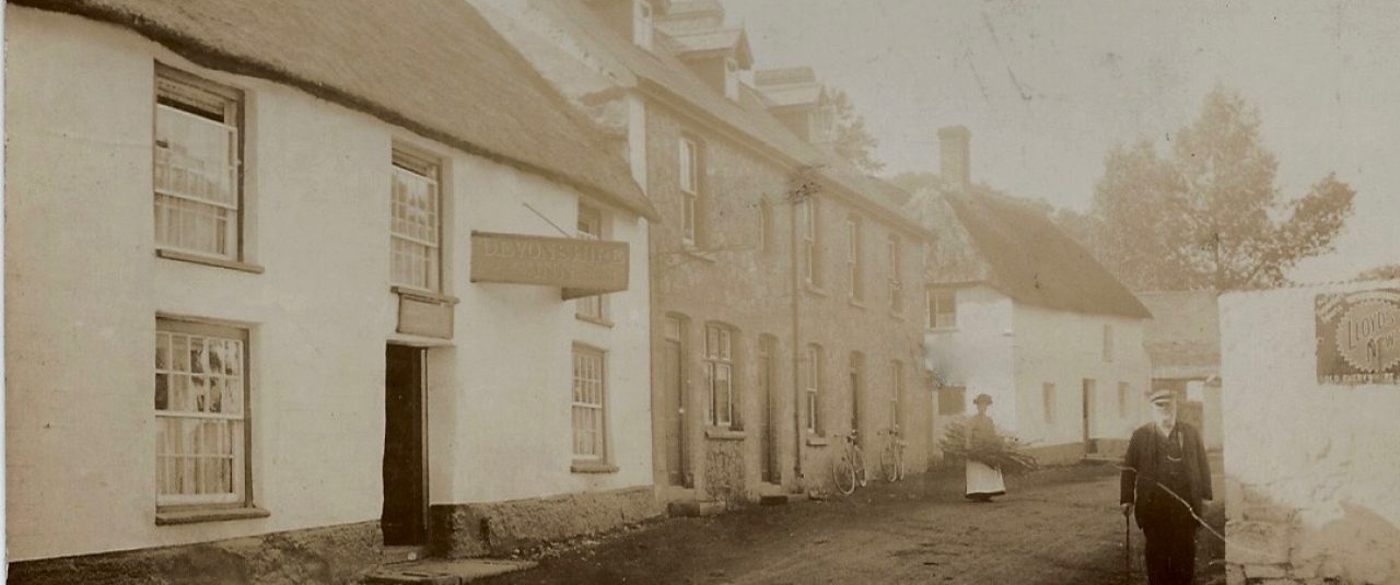
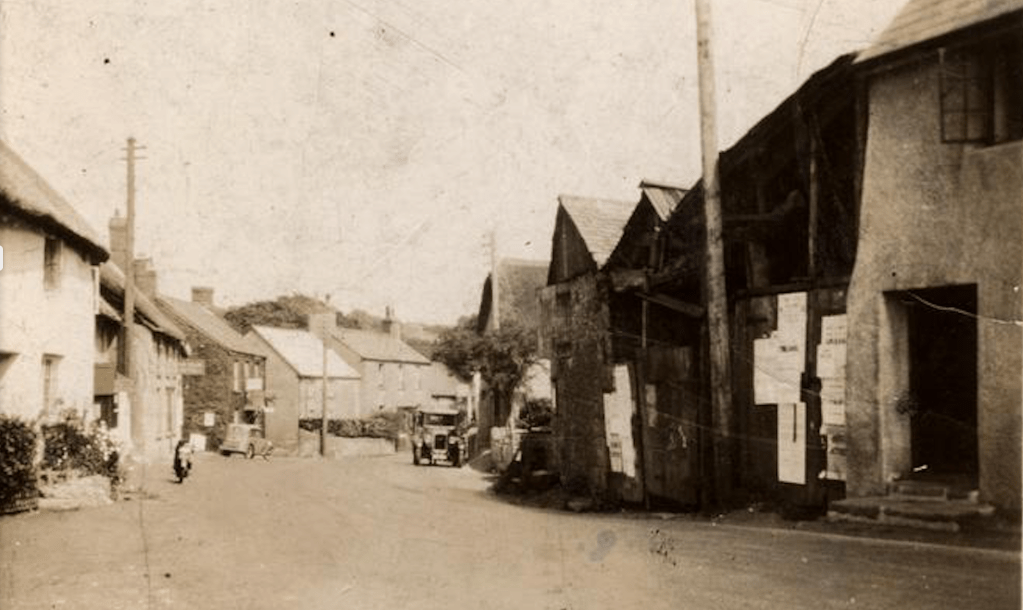
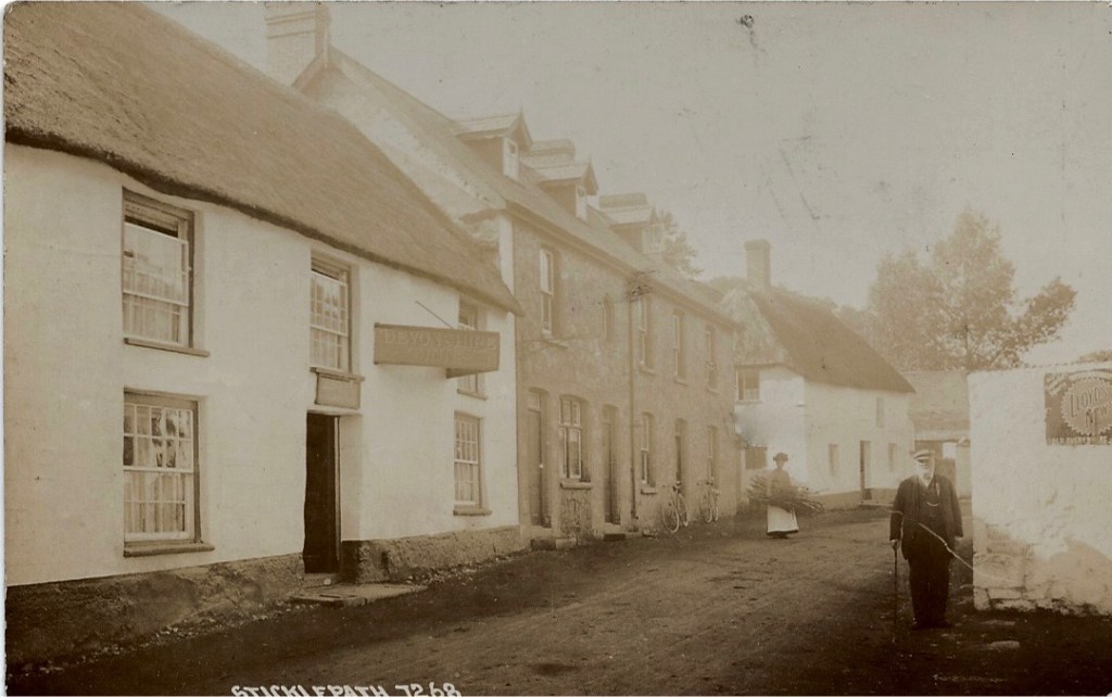
The Taw River Hotel, now Inn. Beyond this the full run of thatched cottages are listed. The man standing by bay windows at the post office of the time. The black area on the left is the smithy known as the Finch Foundry.
Commercial postcard. Photo by Roger Bowden, I am the child in the photo walking past Tudor Cottage and the porch far right is ‘The Dairy’. Mid-1960s. As noted above this whole row of thatched cottages is listed.
Looking back at the Taw River Inn and Village Shop on left. Black buildings on right are Finch Foundry.
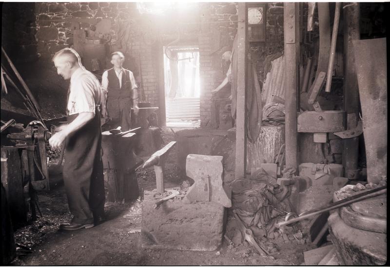
Ralph Finch at work ?late 1950s
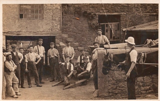
Foundry workers ?1920s (Young Ralph Finch with hand on hip)
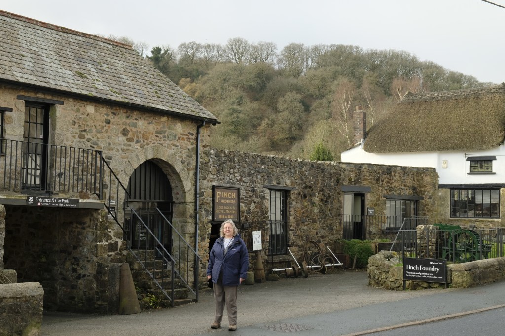
2019 Finch Foundry National Trust (Helen Finch Shields in foreground)
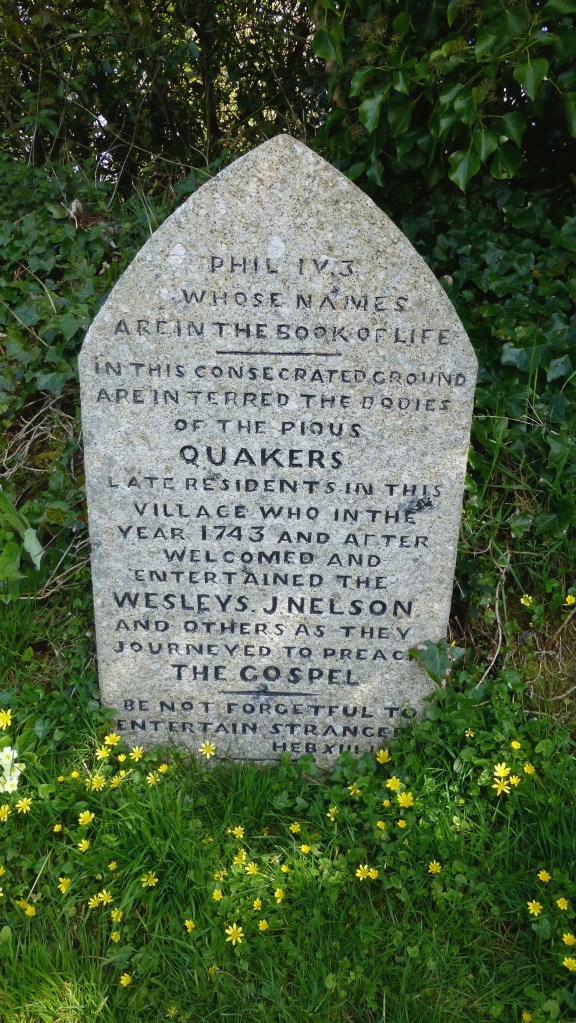
Behind the Foundry site is the village graveyard ‘Quaker Burying Ground’, non-denominal since 1830s.
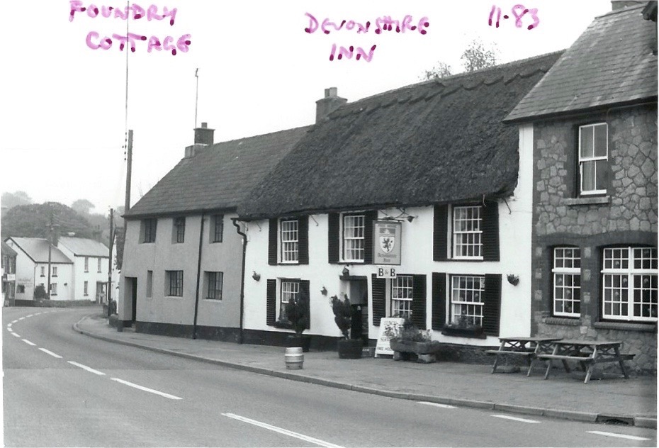
Grey house is Foundry Cottage (listed). Devonshire Inn then two more modern houses, perhaps late 19th century.
Foundry Cottage closest on left. Candle factory on right.
The Devonshire Inn. Note dormer windows, not many on Sticklepath Main Street. Chantry Cottage white house in distance. William Middle, Crimean war veteran walking down the village. Photo about 1905?
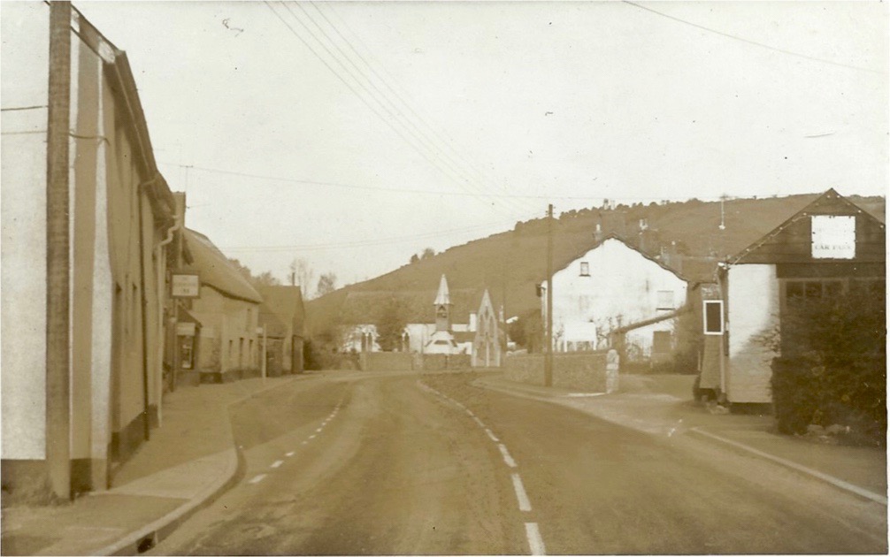
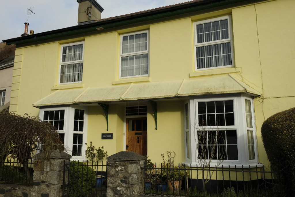
The Devonshire can be seen on the left and a new bay window further on where the Post Office resided then. A bus stop is now sited in front of this and Chantry cottage. Much road widening on the right and pavements added. Large White House on right is Sunnyside. No bus shelters ?1970
Chantry Cottage (listed) 1983. Muriel remembered buying Clotted cream here about 1910
Sunnyside. Home of ‘Butcher Cook’, early 1900s, a generous village character who was Chair of Governors of the village school. (2019)
Sunnyside (listed) 2019
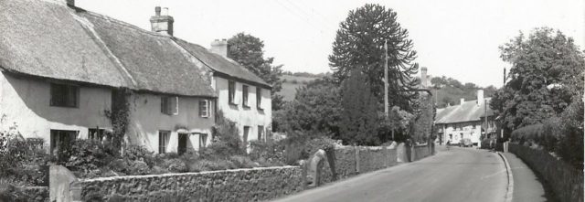
Further on we turn back, Chantry cottage still visible on the right, We see Thomas Pearse’s small round summerhouse in the centre with Sunnyside behind. (Now re-sited in Foundry grounds). The thatched cottages on the left are Staplers and The Heritage. Gutters on thatch are unusual but there are plenty in Sticklepath! Stone walls as seen here are common throughout the village.
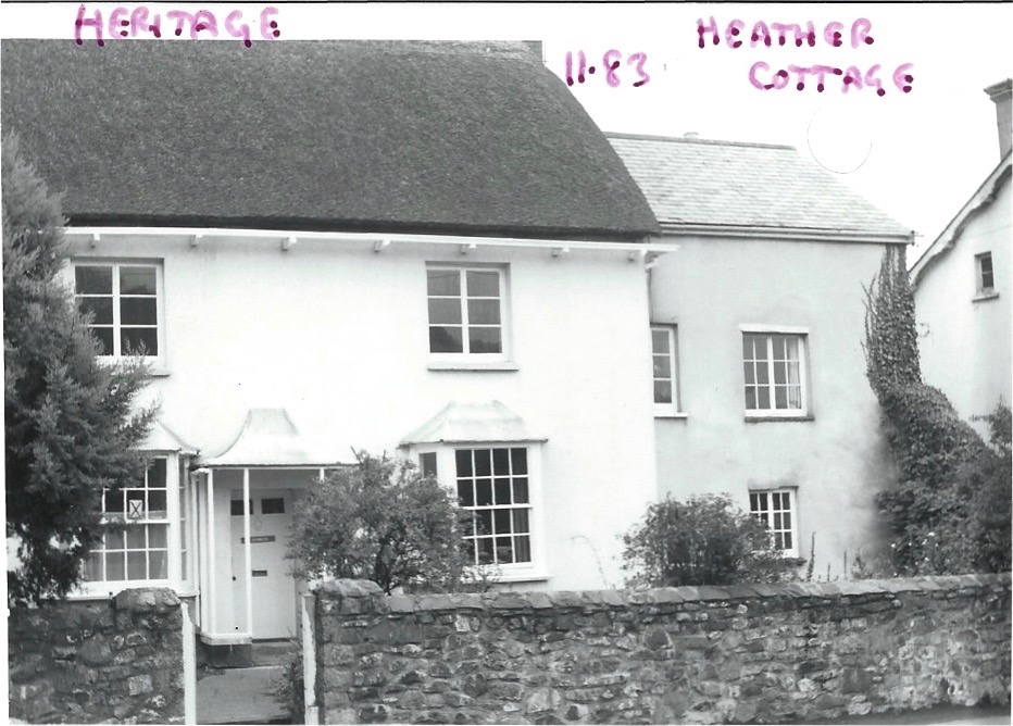
The Heritage, a Quaker’s house 1800s and Heather Cottage tucked back (Photo 1983)
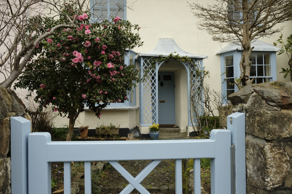
The Heritage 2019
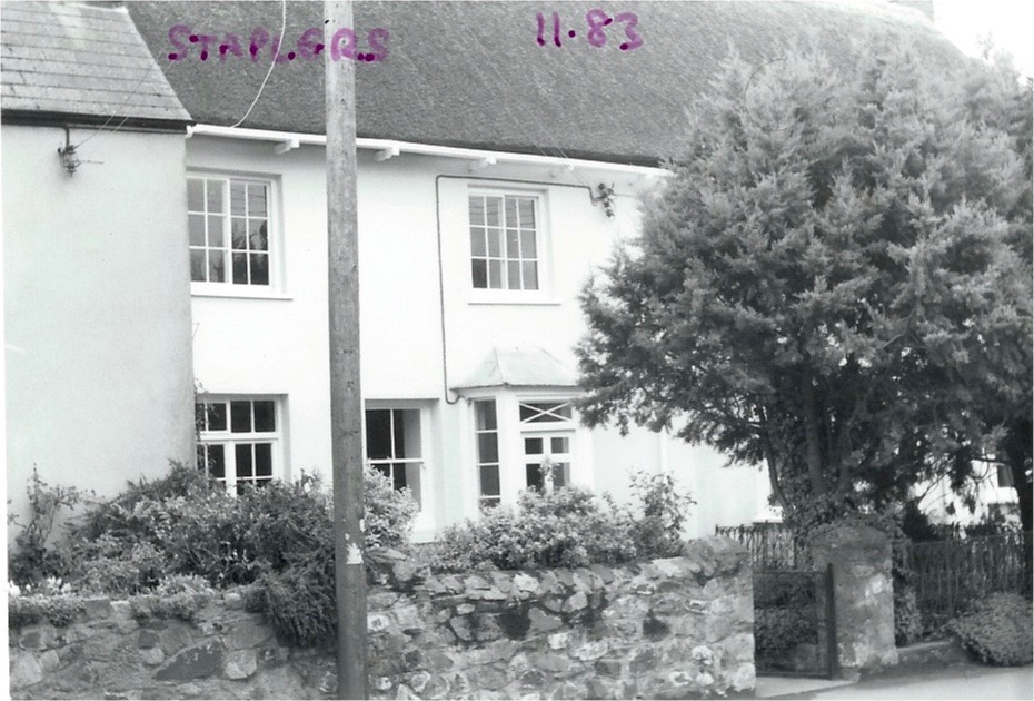
Staplers (built by wool staplers) photo 1983. Crossing over the road again….
One of the few remaining open views to countryside from the village street. Commemorative Plaque, prior to road widening 1928. I think a stand pipe tap can be made out below the plaque. Unusual Bell tower on Wesleyan Methodist Chapel.
Wesleyan Methodist Chapel, (listed) again prior to road widening 1928. Sometimes blue and sometimes painted maroon and pink over the years. The poles, street lights and wires detract from the picturesque village still today. Stone cross on top of unknown origin.
Plaque replaced lower down when the wall was re-built flush with the front of the chapel (no watery pun intended)
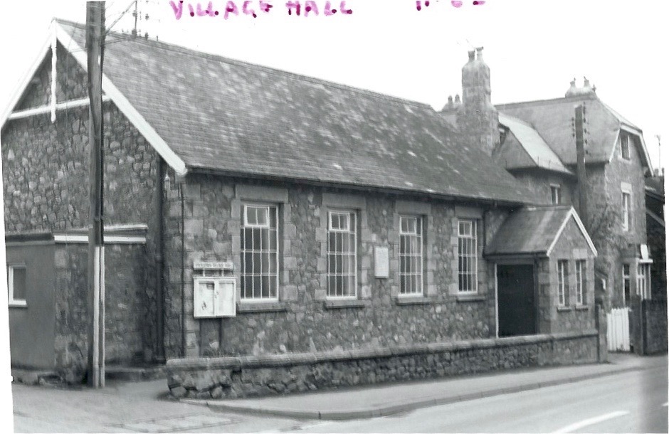
Village Hall with Tawburn House behind (Private house, later care home, now boutique hotel) Photos 1983 by Roger Bowden
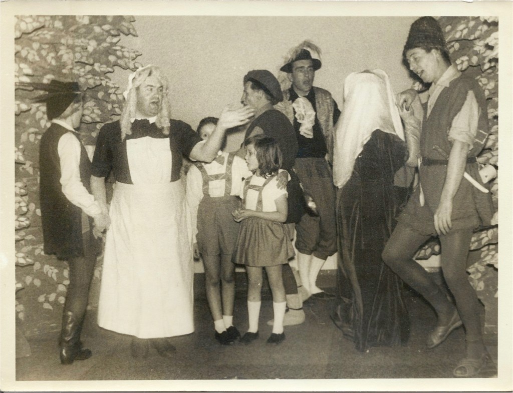
The village hall was a centre of social activity. Bert Stead and villagers performing Babes in the wood 1960s (Photo R.Bowden)
The Old Cottage, between village hall and Skaigh Cottages had 4 entrances/seperate living areas, we see 3 entrances here. An early lamp post. In front of the houses to the left you can see the drain with which flushed household waste away, with stone bridging to each house. I note many stone walls were whitewashed in the past. 1910s?
The Old Cottage 2019. (Front wall clearly moved back to allow for pavement and road widening)
View on up the street, plaque visible bottom left, chapel (sadly dilapidated pink) and opposite is the village hall and row of 4 Skaigh View Cottages with matching porches, the old stables behind them and well pump are of some historical interest. (Photos 2019 by Michael Shields)
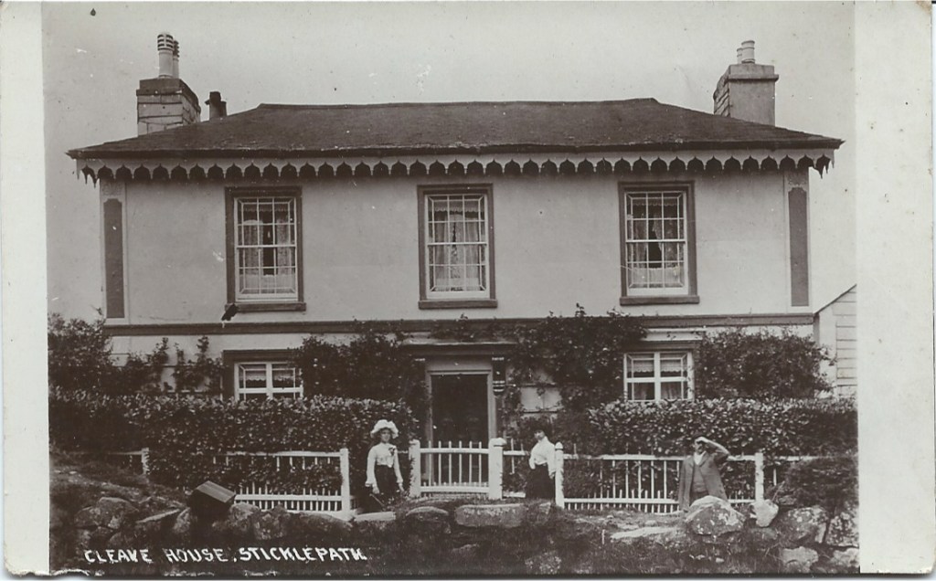
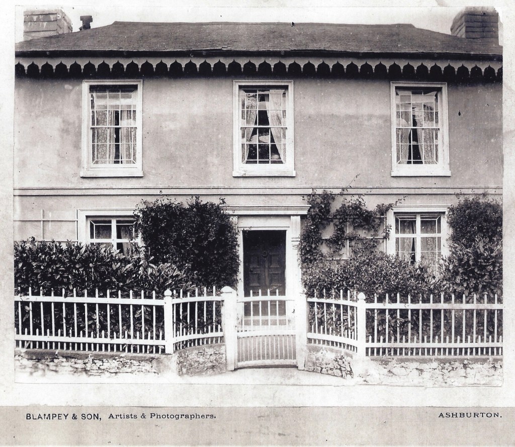
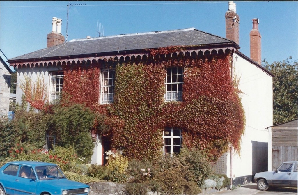
Cleave House, listed. ( The outline floor area is very similar to The Old Cottage)
Cleave House demonstrating the uneven glass panes. I think the iron railings were taken down during WWII?
Cleave House, built 1850s, likely by Mill owners, Ska or Skaigh View Cottages built soon after perhaps for their workers. Photo late 1970s?
Note the black wheelwright’s mandrel and the long rows of high windows are where his workshop was, labelled as ‘smithy’ on some maps. The upstairs was 23 foot length.
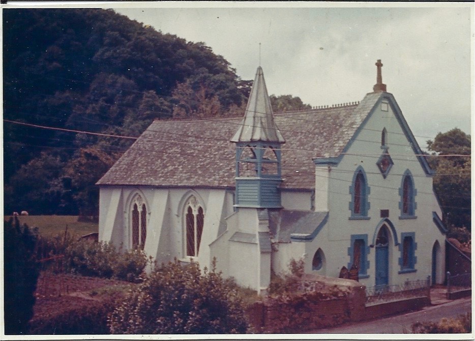
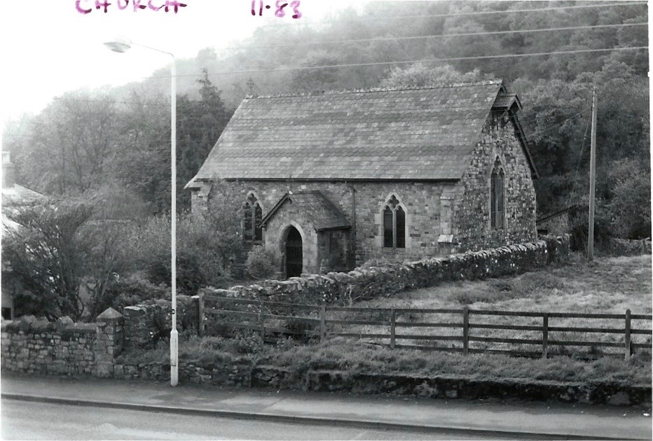
St Mary’s (Anglican) Chapel of Ease. 1983. At the top of this field on the right as we look …..
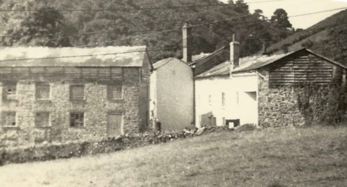
Remains of the Cleave Mills. Late 1960s? Would have been a landmark up to that time.
Mill buildings from far side showing closeness of Taw and also conversion to accommodation (Photo 2019)
Ladywell. Mrs Elderton
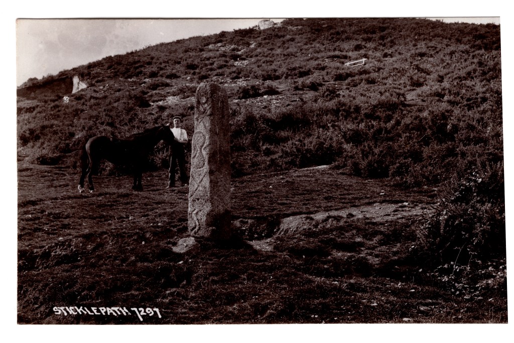
Standing stone, Parish boundary marker, showing inscription, now much corroded. Pre-1910?
Further up the lane to Belstone in the Skaigh Valley used to be visible the remains of the largest waterwheel in Mainland Britain at 70 ft diameter.
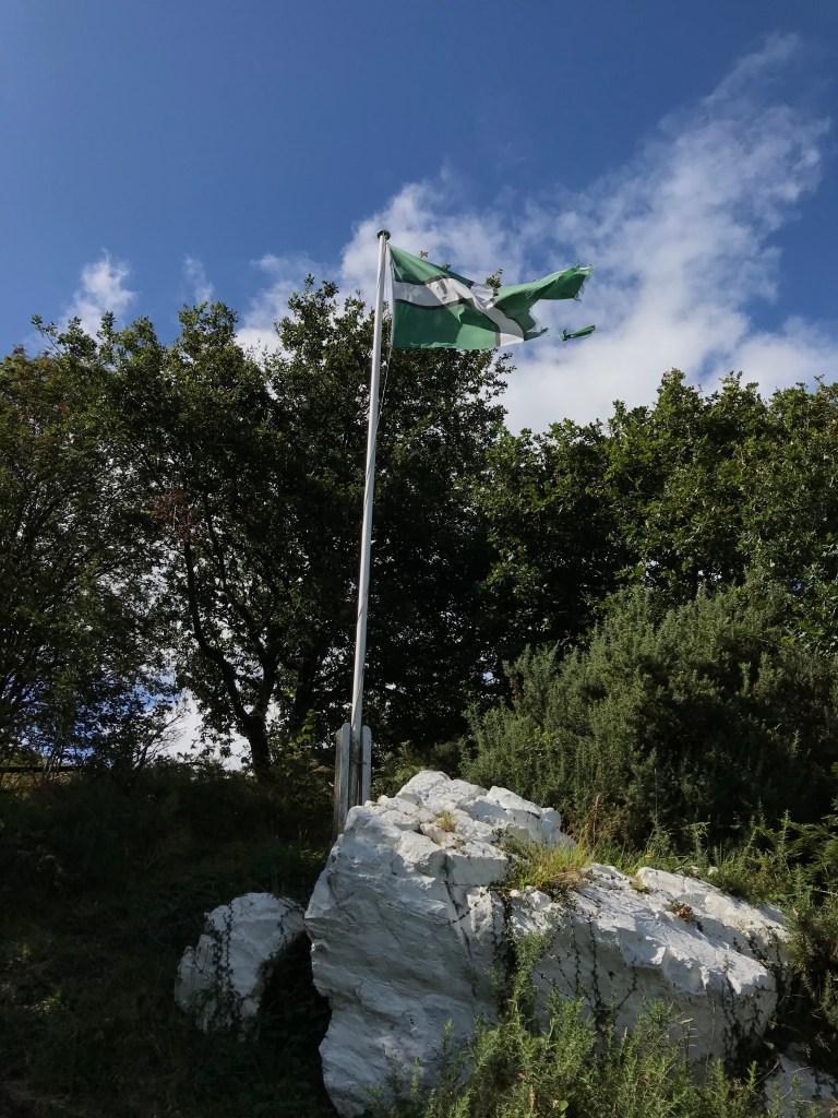
White Rock and flag pole. Wesley is said to have preached here
Many dates for the photographs are guesses. Please add comments if you spot something that suggests a different date or you have more information. I am always pleased to hear thoughts or opinions. Do contact me if you have any questions or any photos to add!