What does one call a collection of landmarks? A Glut? An Album? A Crowd? I have settled on a ‘Tour’ of landmarks, from right to left on the map below. Some will be the focus of a blog, but not all!
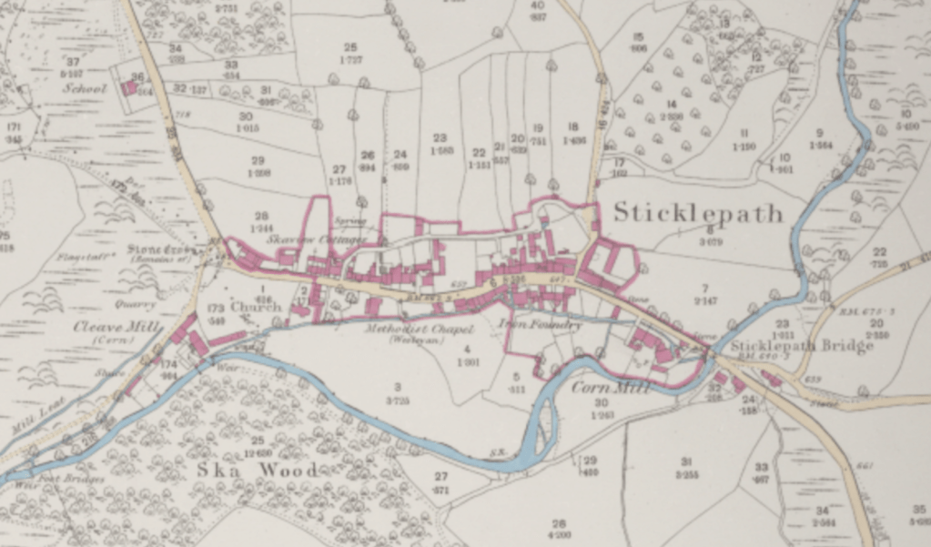
The British Library 25 inch 1841-1952 ℅ The National Library of Scotland website. Many landmarks marked (1886) eg Bridge, cornmill, foundry, chapel, Ska or Skaigh View Cottages, church, stone ‘cross’, flagstaff, quarry, Cleave Mill, mill leat. School also (top left – no image available)
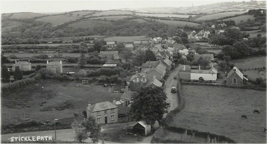
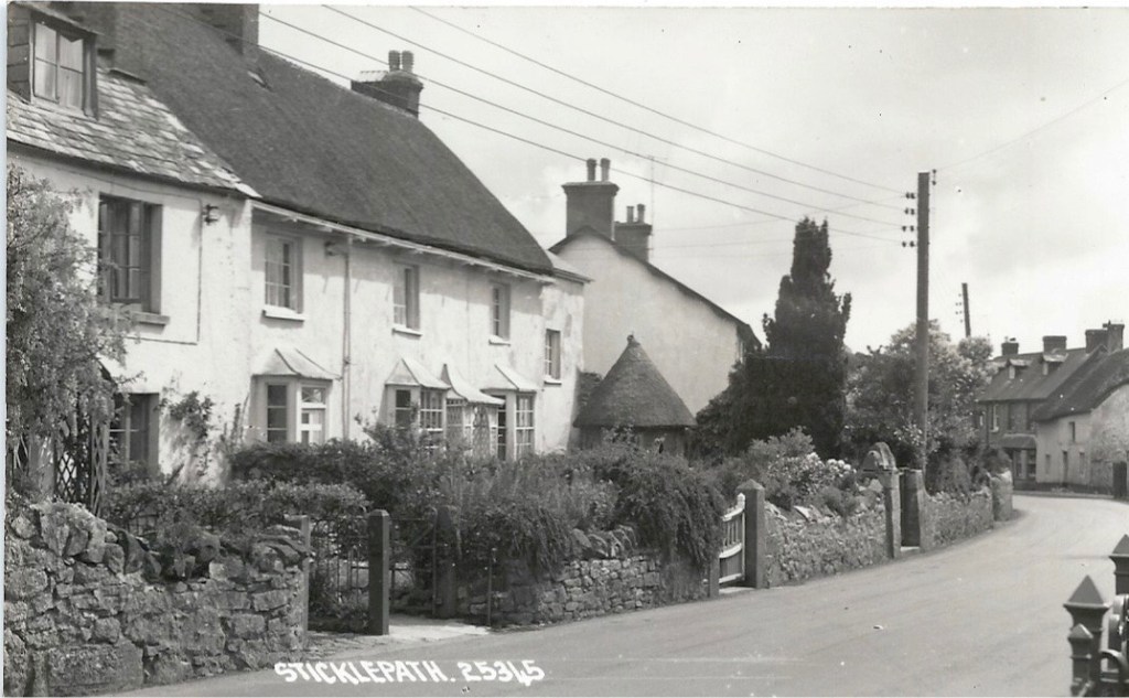
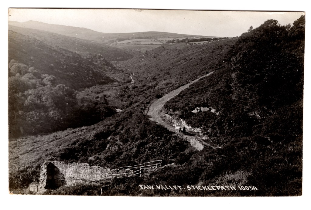
View entering Sticklepath “Western and Carnoll” mills on left side behind white Bridge House, with row of Elm Trees on right, pre-1928 Top left corner quarry below ‘White Rock’ with its flagstaff. School seen half way up the hill to right of midline.
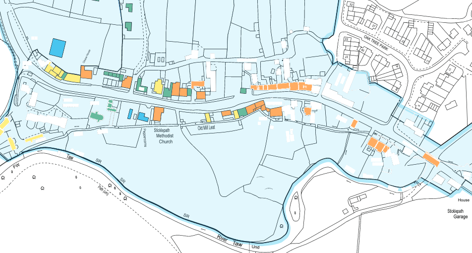
Part of Sticklepath Historic Quality and Integrity map page 19 of Sticklepath Village “Conservation Area Character Appraisal” June 2017 by Dartmoor National Park Authority. Grade II or II* listed buildings and features marked in orange, images below where I can.
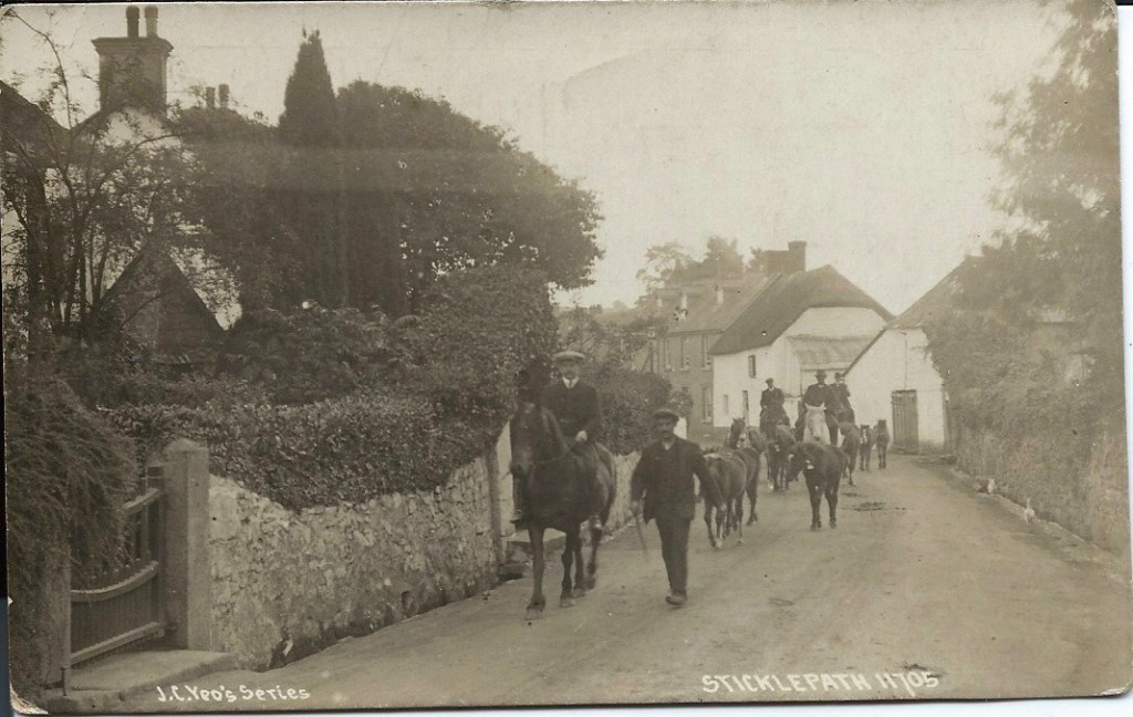
The River Taw flowing under Sticklepath Bridge 1905 approx.
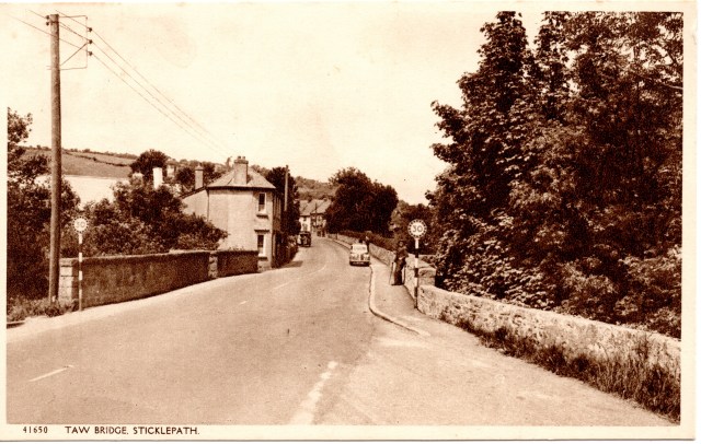
View across the bridge. 1930s?
A plaque commemorating the bridge widening 1928 and old parish boundary stone Sampford Courtenay to South Tawton
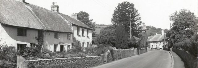
Mill House, Taw Leat and Silverlake, (listed). The Monkey Puzzle tree let me know I was home in 1960s.
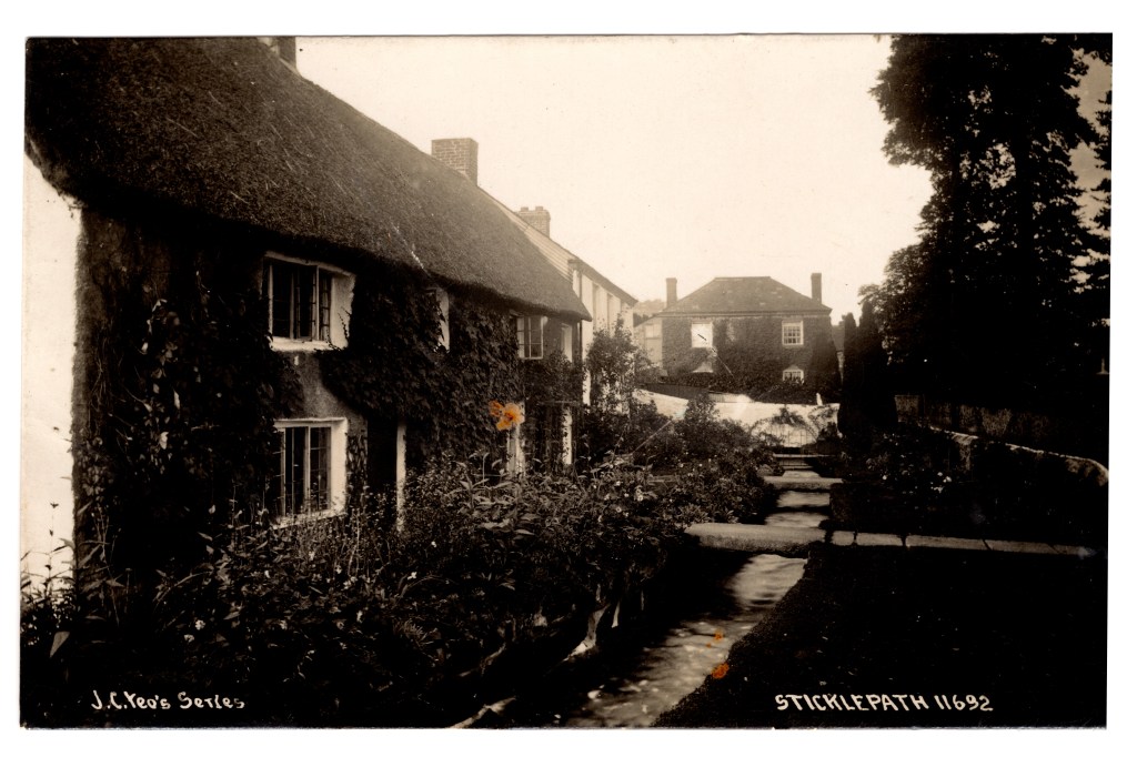
The leat runs uniquely in front of these houses, then to the left of Primula the house facing us and behind all the other houses. Note the large granite slabs forming bridges over the leat. Chapman postcard, I presume commissioned by Yeo of Sticklepath Post Office. 1910s
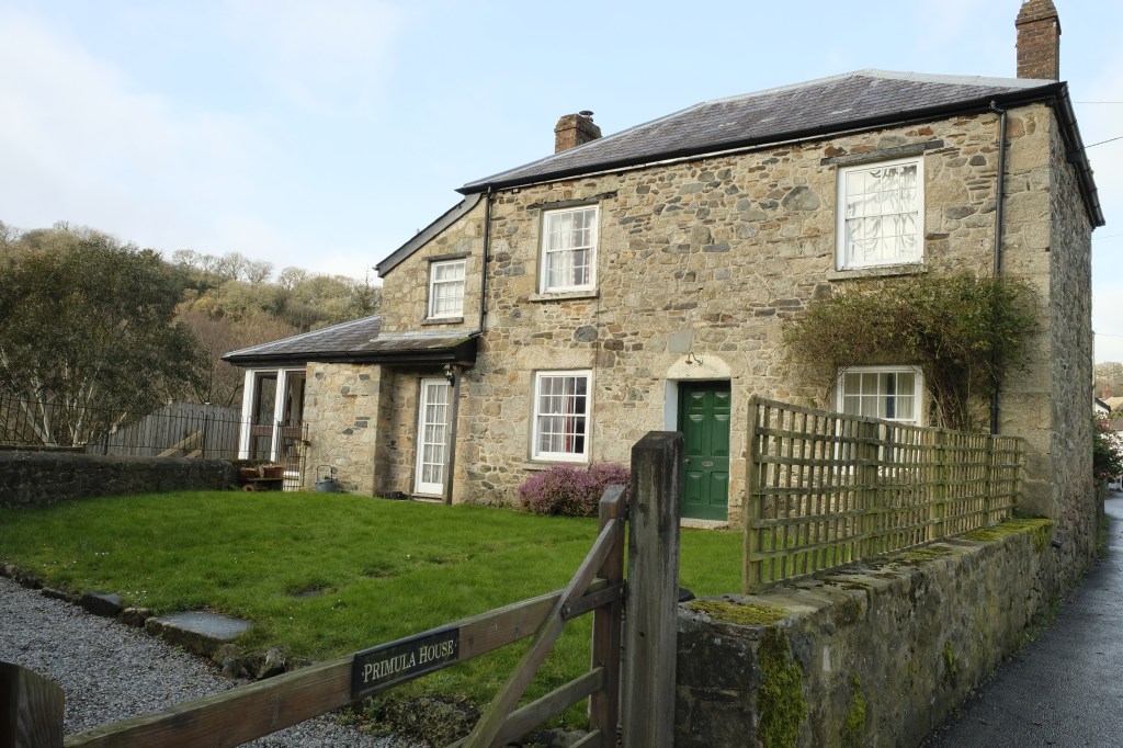
Primula House (Previously Temperence). Inset County ‘C’ stone adjacent to the road. 2019
C stone marking the extent of road maintenance from the bridge by the County, built into side of Primula House (listed)
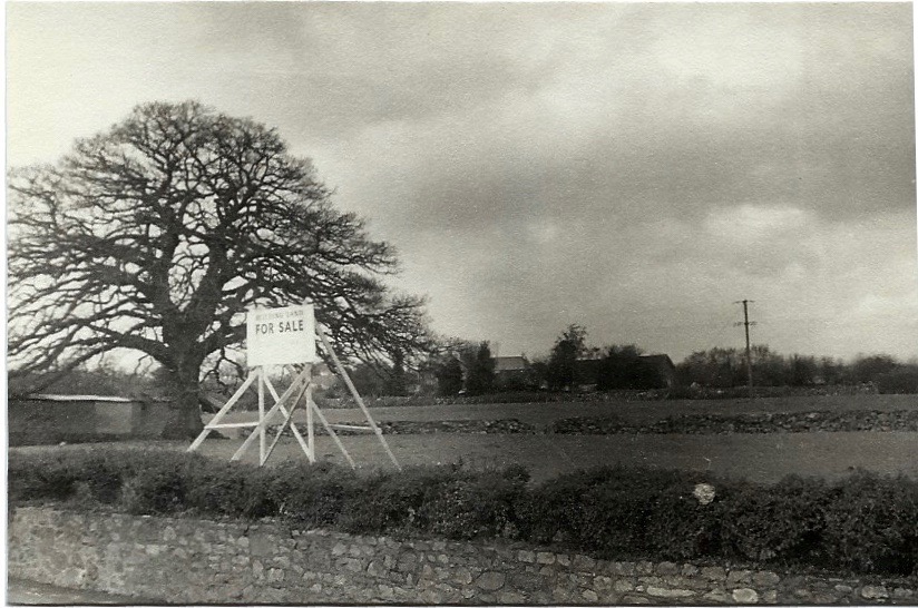
On the opposite side of the road, Oak tree in field for sale in 1970s
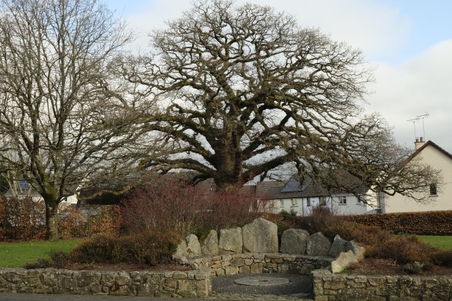
Same oak tree with the Millennium Seat (2000) and Oaktree Park Houses (photo 2019)
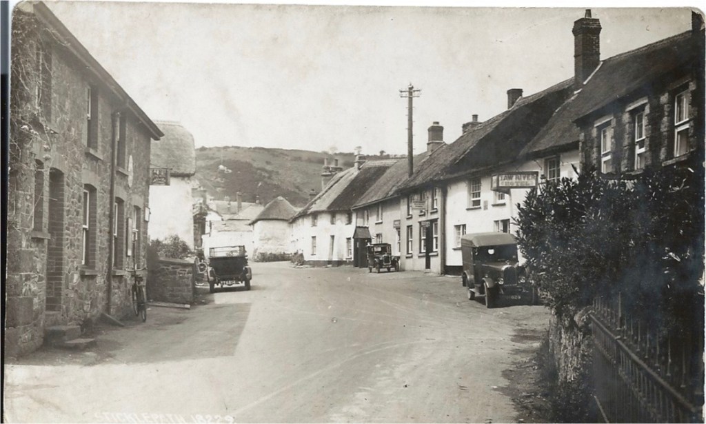
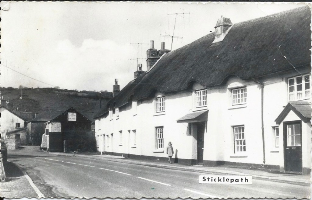
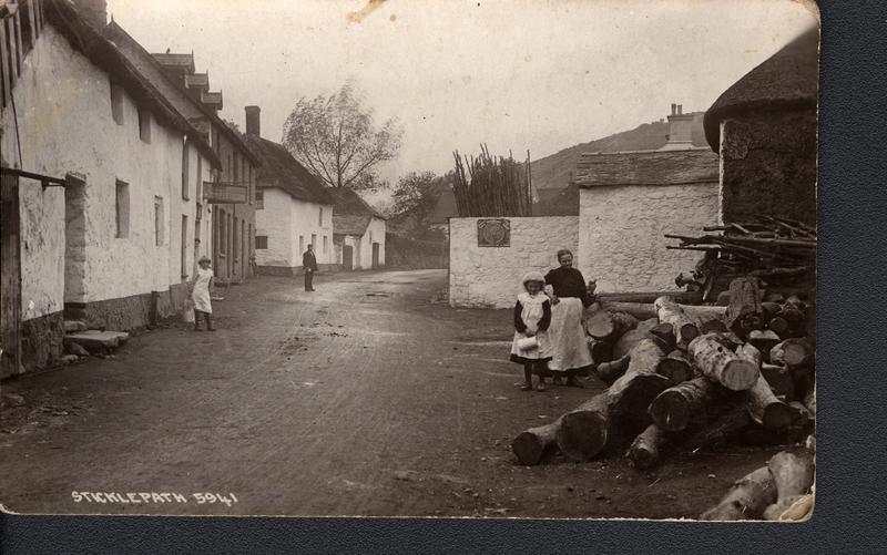
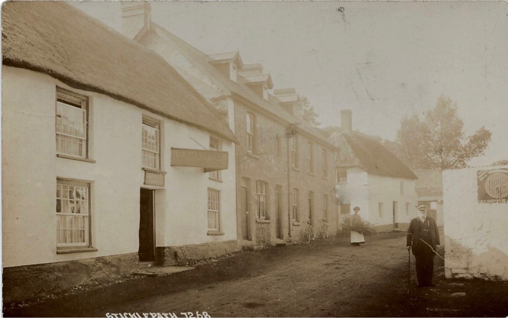
Walking on, the White House on the left was the first post office, then the house on the right by telegraph pole, the two small cottages closer to us on the left took turns being the post office later. Much more recently it moved across the road to the now Village Stores, first building on the right. The Taw River ‘Hotel’ is seen. The black porch marks ‘The Dairy’. The thatched square white building protruding in the distance is where the candle factory was.
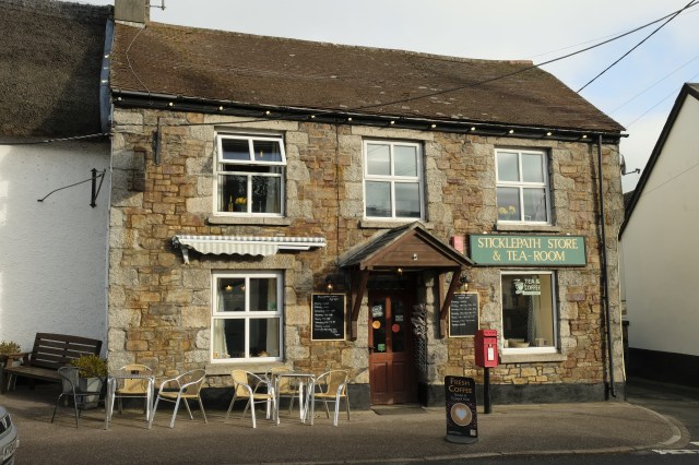
Village shop 2019
The Taw River Hotel, now Inn. Beyond this the full run of thatched cottages are listed. The man standing by bay windows at the post office of the time. The black area on the left is the smithy known as the Finch Foundry.
Commercial postcard. Photo by Roger Bowden, I am the child in the photo walking past Tudor Cottage and the porch far right is ‘The Dairy’. Mid-1960s. As noted above this whole row of thatched cottages is listed.
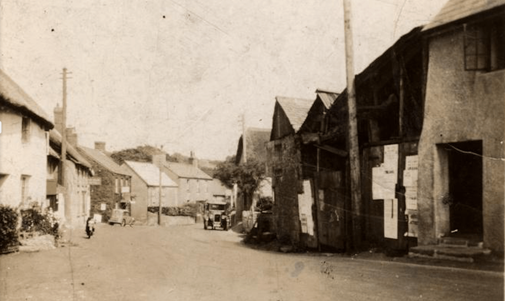
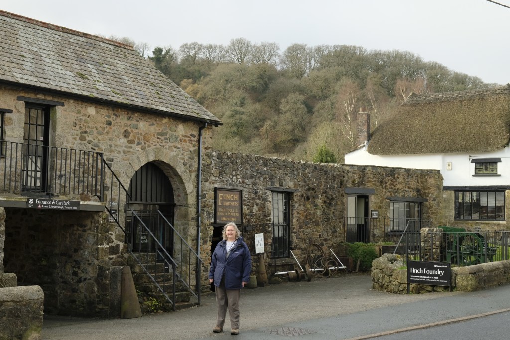
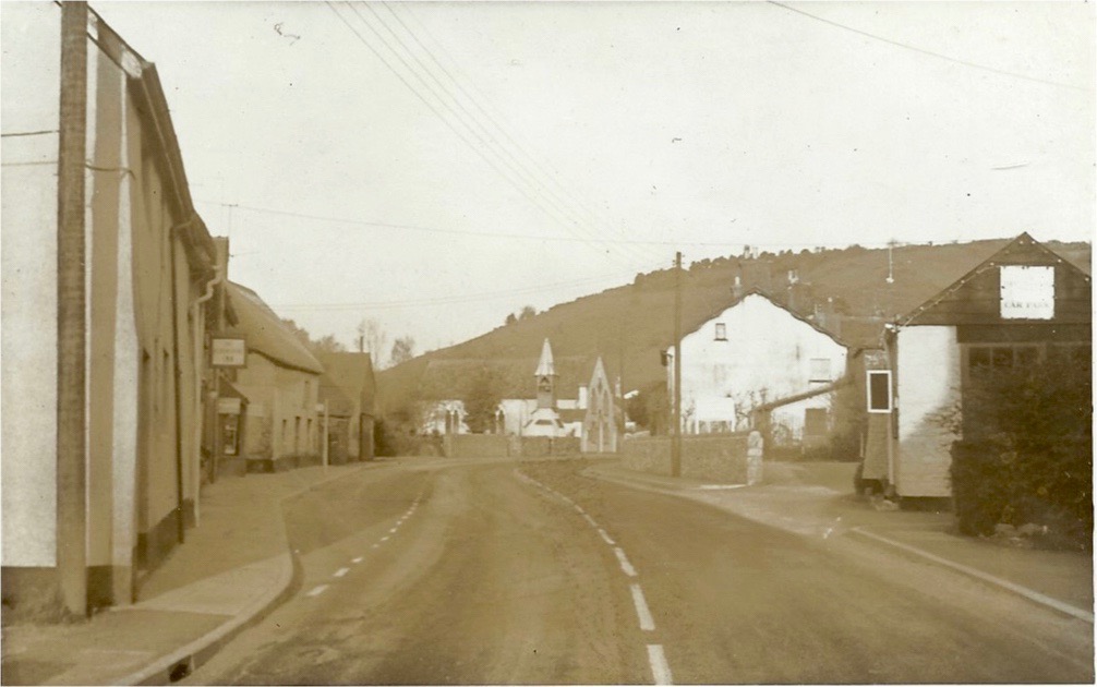
Looking back at the Taw River Inn and Village Shop on left. Black buildings on right are Finch Foundry.
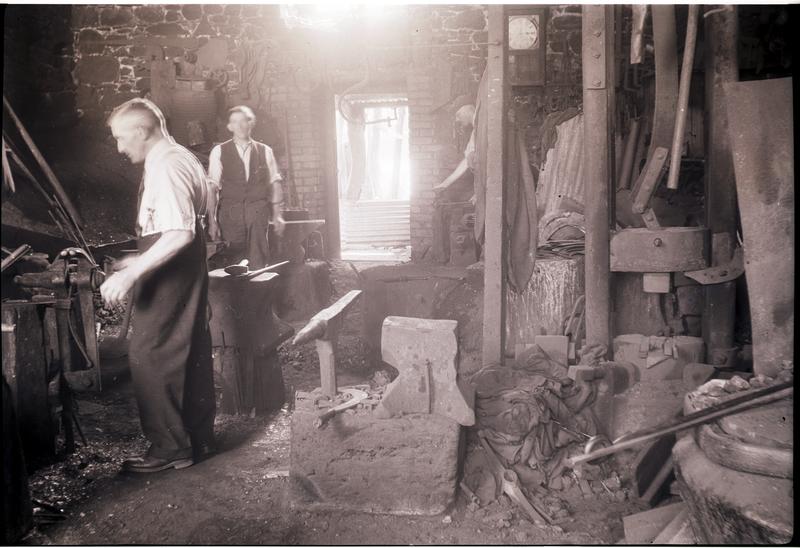
Ralph Finch at work ?late 1950s
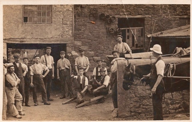
Foundry workers ?1920s (Young Ralph Finch with hand on hip)
2019 Finch Foundry National Trust (Helen Finch Shields in foreground)
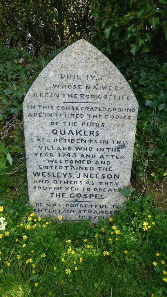
Behind the Foundry site is the village graveyard ‘Quaker Burying Ground’, non-denominal since 1830s.
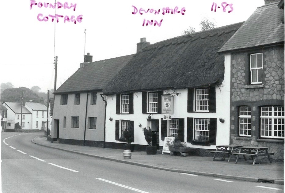
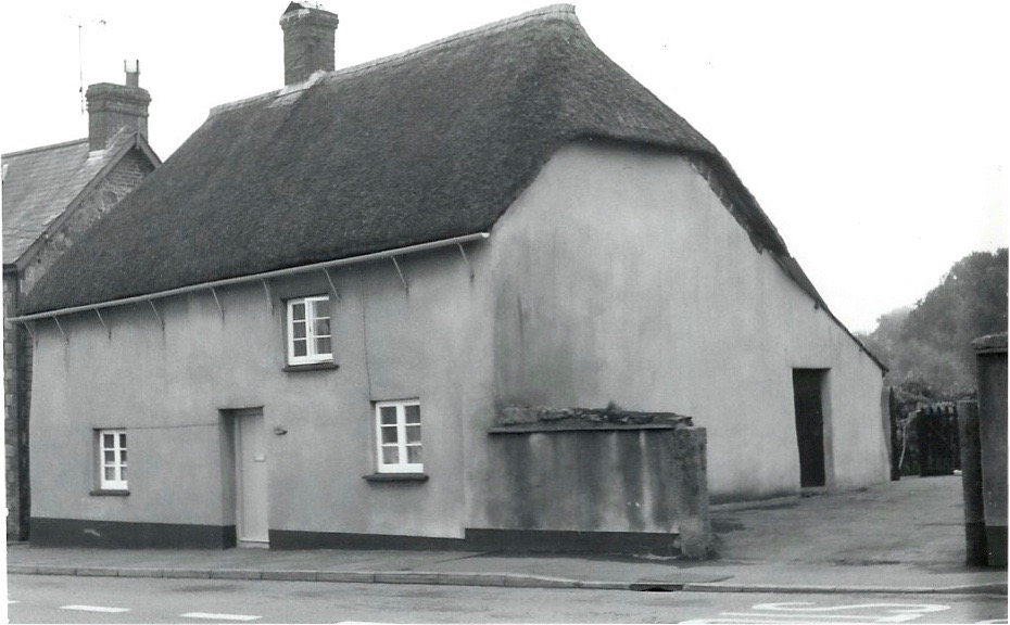
Grey house is Foundry Cottage (listed). Devonshire Inn then two more modern houses, perhaps late 19th century.
Foundry Cottage closest on left. Candle factory on right.
The Devonshire Inn. Note dormer windows, not many on Sticklepath Main Street. Chantry Cottage white house in distance. William Middle, Crimean war veteran walking down the village. Photo about 1905?
The Devonshire can be seen on the left and a new bay window further on where the Post Office resided then. A bus stop is now sited in front of this and Chantry cottage. Much road widening on the right and pavements added. Large White House on right is Sunnyside. No bus shelters ?1970
Chantry Cottage (listed) 1983. Muriel remembered buying Clotted cream here about 1910
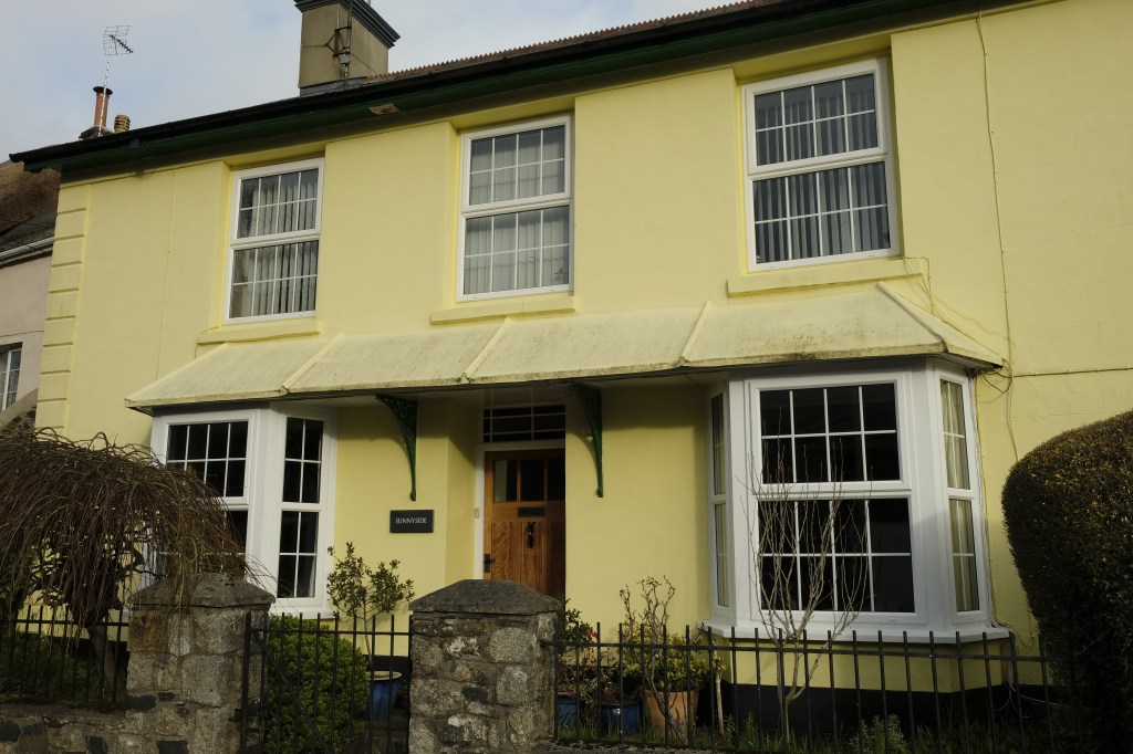
Sunnyside. Home of ‘Butcher Cook’, early 1900s, a generous village character who was Chair of Governors of the village school. (2019)
Sunnyside (listed) 2019
Further on we turn back, Chantry cottage still visible on the right, We see Thomas Pearse’s small round summerhouse in the centre with Sunnyside behind. (Now re-sited in Foundry grounds). The thatched cottages on the left are Staplers and The Heritage. Gutters on thatch are unusual but there are plenty in Sticklepath! Stone walls as seen here are common throughout the village.
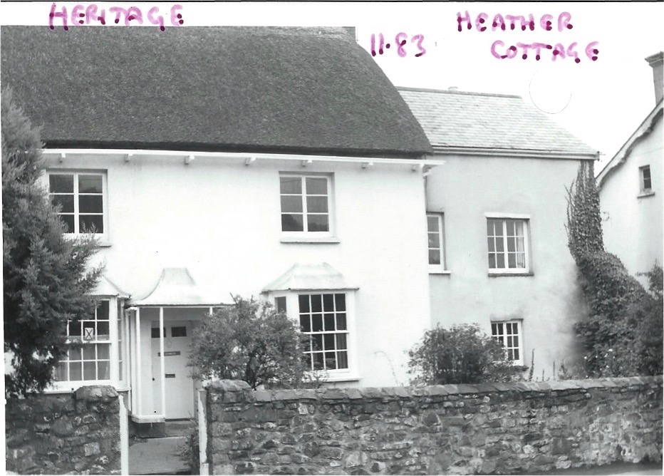
The Heritage, a Quaker’s house 1800s and Heather Cottage tucked back (Photo 1983)
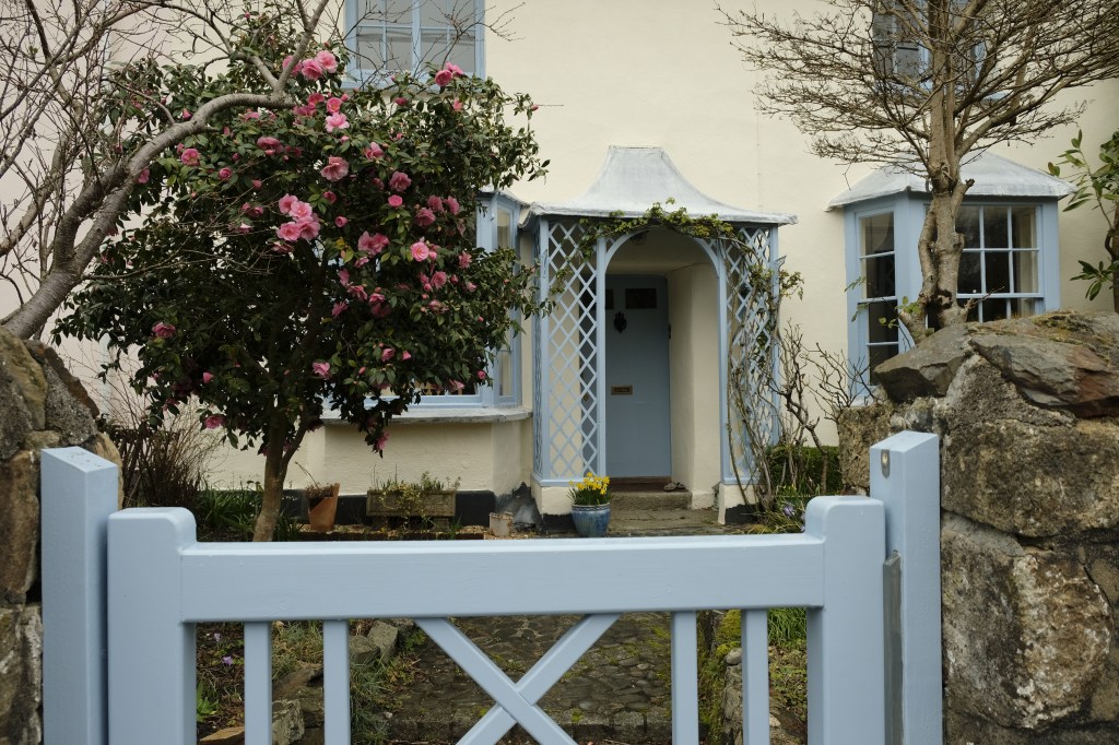
The Heritage 2019
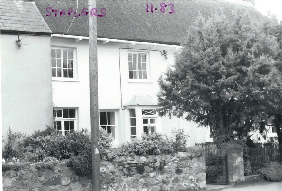
Staplers (built by wool staplers) photo 1983. Crossing over the road again….
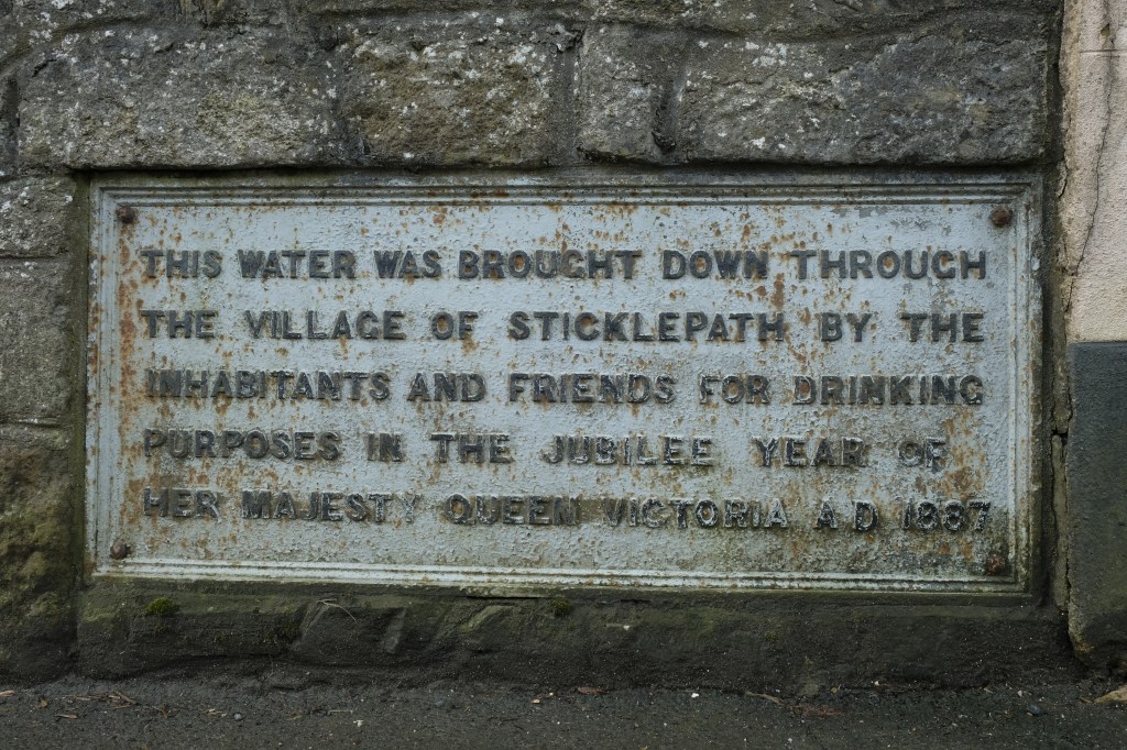
One of the few remaining open views to countryside from the village street. Commemorative Plaque, prior to road widening 1928. I think a stand pipe tap can be made out below the plaque. Unusual Bell tower on Wesleyan Methodist Chapel.
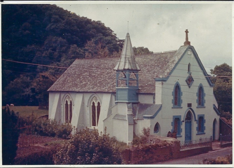
Wesleyan Methodist Chapel, (listed) again prior to road widening 1928. Sometimes blue and sometimes painted maroon and pink over the years. The poles, street lights and wires detract from the picturesque village still today. Stone cross on top of unknown origin.
Plaque replaced lower down when the wall was re-built flush with the front of the chapel (no watery pun intended)
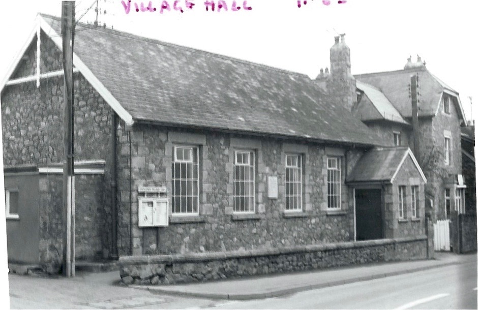
Village Hall with Tawburn House behind (Private house, later care home, now boutique hotel) Photos 1983 by Roger Bowden
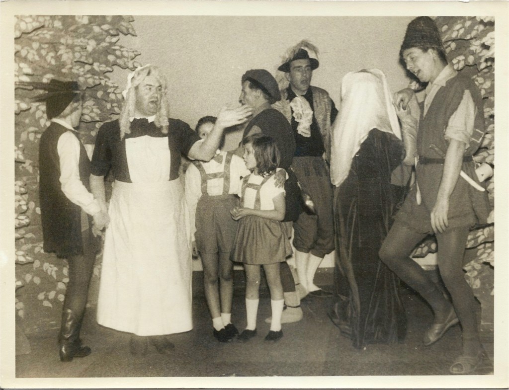
The village hall was a centre of social activity. Bert Stead and villagers performing Babes in the wood 1960s (Photo R.Bowden)
The Old Cottage, between village hall and Skaigh Cottages had 4 entrances/seperate living areas, we see 3 entrances here. An early lamp post. In front of the houses to the left you can see the drain with which flushed household waste away, with stone bridging to each house. I note many stone walls were whitewashed in the past. 1910s?
The Old Cottage 2019. (Front wall clearly moved back to allow for pavement and road widening)
View on up the street, plaque visible bottom left, chapel (sadly dilapidated pink) and opposite is the village hall and row of 4 Skaigh View Cottages with matching porches, the old stables behind them and well pump are of some historical interest. (Photos 2019 by Michael Shields)
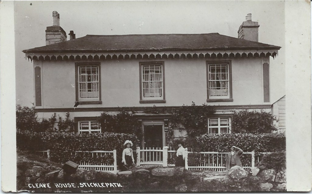
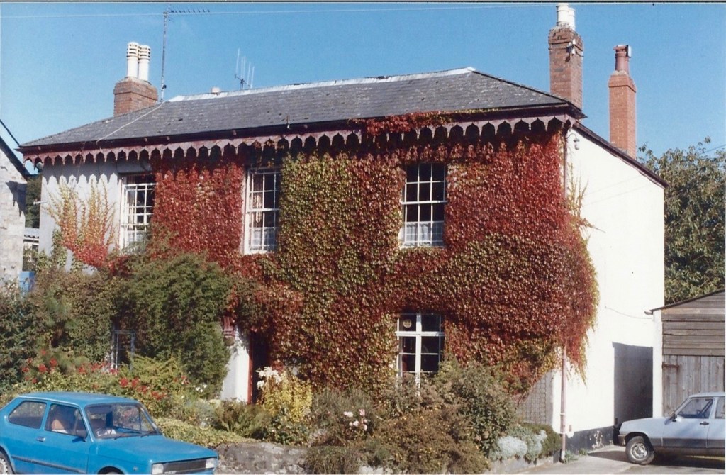
Cleave House, listed. ( The outline floor area is very similar to The Old Cottage)
Cleave House demonstrating the uneven glass panes. I think the iron railings were taken down during WWII?
Cleave House, built 1850s, likely by Mill owners, Ska or Skaigh View Cottages built soon after perhaps for their workers. Photo late 1970s?
Note the black wheelwright’s mandrel and the long rows of high windows are where his workshop was, labelled as ‘smithy’ on some maps. The upstairs was 23 foot length.
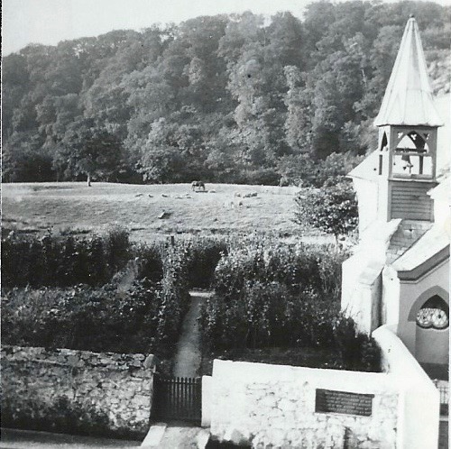
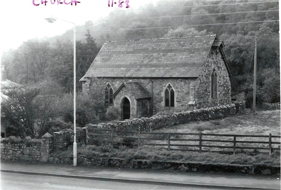
St Mary’s (Anglican) Chapel of Ease. 1983. At the top of this field on the right as we look …..
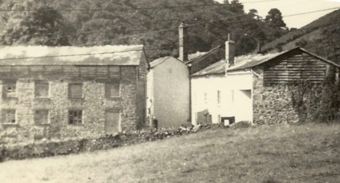
Remains of the Cleave Mills. Late 1960s? Would have been a landmark up to that time.
Mill buildings from far side showing closeness of Taw and also conversion to accommodation (Photo 2019)
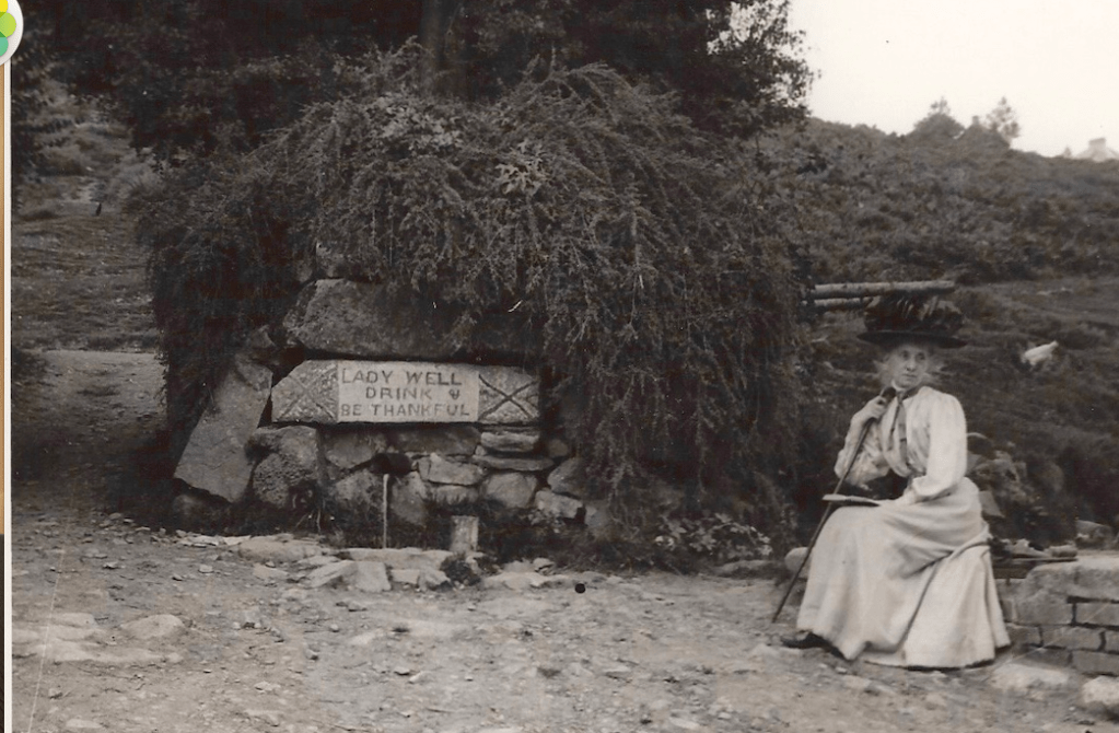
Ladywell. Mrs Elderton
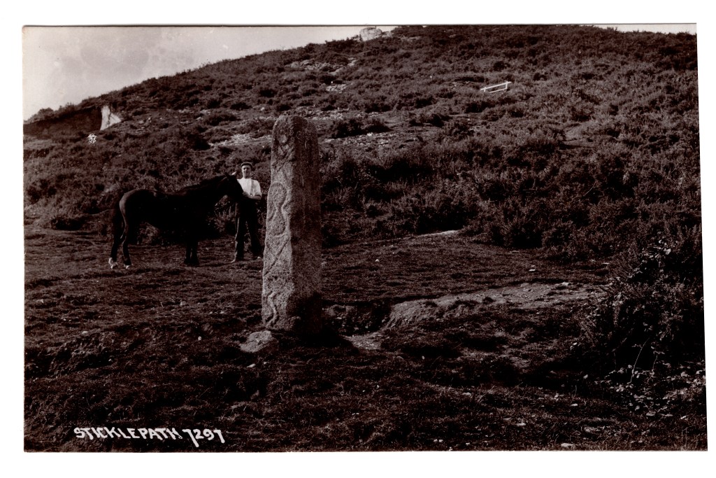
Standing stone, Parish boundary marker, showing inscription, now much corroded. Pre-1910?
Further up the lane to Belstone in the Skaigh Valley used to be visible the remains of the largest waterwheel in Mainland Britain at 70 ft diameter.
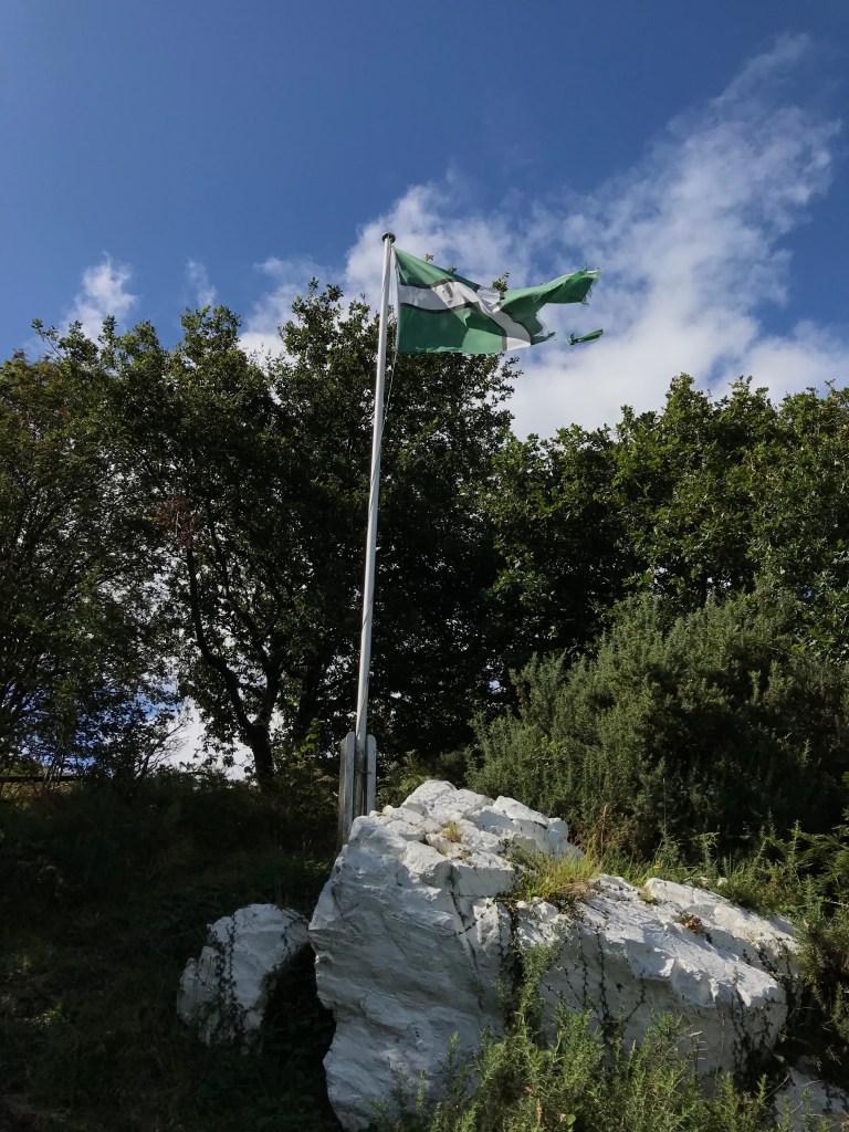
White Rock and flag pole. Wesley is said to have preached here
Many dates for the photographs are guesses. Please add comments if you spot something that suggests a different date or you have more information. I am always pleased to hear thoughts or opinions. Do contact me if you have any questions or any photos to add!
From memory Thomas Pearse built The Heritage in the grounds of his father’s house. Have you seen the Pearse document where they describe family get togethers at Christmas? I think, if memory is correct, Staplers was previously Little Blackdown which was a Quaker house.


We live in The Heritage and it was lovely to see the photo of the summer house in the garden. I really enjoyed looking at these photos, thank you.
LikeLike
From memory Thomas Pearse built The Heritage in the grounds of his father’s house. Have you seen the Pearse document where they describe family get togethers at Christmas? I think, if memory is correct, Staplers was previously Little Blackdown which was a Quaker house.
LikeLike
Pingback: Contact details – Sticklepath a Village and its People
Pingback: Ramblings on #OnePlaceEnvironment – #Sticklepath – Sticklepath a Village and its People