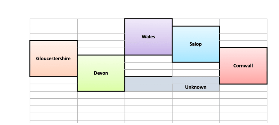
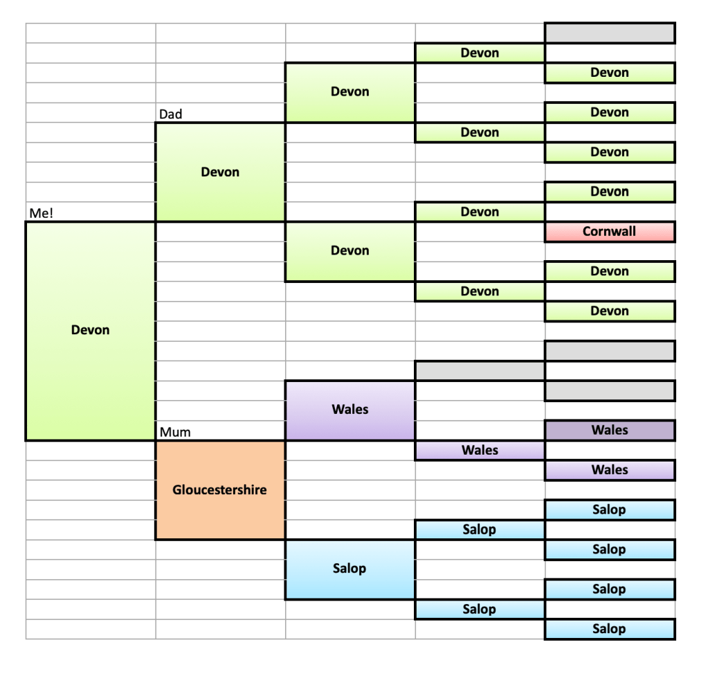
The idea is simple. Start with yourself on the left and put your geographical details – usually place of birth. Then do the same for each generation of your ancestors in the following columns. Parents, grandparents etc. I have chosen to use English counties and ‘Wales’ as the county names were rather long! You could be more specific with towns or Parishes, or if your ancestors emigrated widely perhaps use countries.
(Download a blank 5 generation chart. Many thanks to J Paul Hawthorne https://geneaspy.com, and to Sophie@Derbygenes for bringing it to my attention)
From this, with a little IT magic it should be possible to create a map of the ancestors origins. (Anyone like to tell me an easy way to do that?)
I was born in Okehampton (the nearest town) as was my father, but we lived in Sticklepath. All the other Devon ancestors except one were born in Sticklepath or in Sampford Courtenay Parish of which Sticklepath was a part.
Salop is the old name for Shropshire or Shrewsbury. My Welsh grandfather was born in Merionethshire and his mother and her parents were from Denbighshire. The grey boxes are unknown ancestors who I hope soon to investigate using DNA.
It makes a colourful image to add to our family history, but this analysis also helps us investigate those unknown ancestors. Considering the geography helps when trying to identify which ‘Sarah Jones’ is likely to be the right one – logical reasoning using a map can help make sense of our evidence.
Always bear in mind however there will be ‘oddities’ like my Mother, the only one born in Gloucestershire. Such individuals stand out clearly and that draws us in to investigate. Why did her parents move? And, especially for more ancient ancestors, how – by canal, sea, rail or road.
Many trains from Wales went through Shrewsbury (See map). This was where my Welsh grandfather moved, in order to work in Bradley’s gentleman’s outfitters. Relatively easy access to visit family back in Wales. There he met his Shropshire lass and they moved to work in Wotton-Under-Edge, Gloucestershire, where Mum was born, before buying a shop in Bristol. From there my mother went to University in Devon and never really left!
If only I was artistic I would draw a map showing the Welsh shopkeeper whose son went to Shrewsbury by train where he met his love in a hat shop, then moved to Bristol to work for the aerospace industry alongside running their own greengrocer’s shop. Their student daughter travelled from Bristol, again by train, to Exeter’s University, gaining her degree. She took bicycle trips and some walks on Dartmoor during courtship, then helped her new Devonian husband run a lorry business. They took pit props and steel to Wales, thus completing the circle! They also transported some of the construction materials for ‘British Steel’, the yacht in which Chay Blyth circumnavigated the globe ‘the wrong way’ in the 1970s.
What would your ancestral maps look like?
For more inspiration Google ‘illustrated maps’. For some great examples, see Tom Woolley who offers articles on how to create your own too.
The next in this series will be accessible here

I need to revisit my mapping chart at some point, as it’s a about 5 years ago since I did it. I did adapt it slightly to include places within counties, and birth dates. It is a worthwhile exercise. I also did a similar mapping chart with death causes.
LikeLiked by 1 person