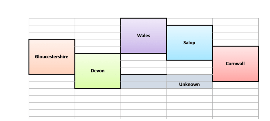
The idea is simple. Start with yourself on the left and put your geographical details – usually place of birth. Then do the same for each generation of your ancestors in the following columns. Parents, grandparents etc. I have chosen to use English counties and ‘Wales’ as the county names were rather long! You could be more specific with towns or Parishes, or if your ancestors emigrated widely perhaps use countries.
From this, with a little IT magic it should be possible to create a map of the ancestors origins. (Anyone like to tell me an easy way to do that?)
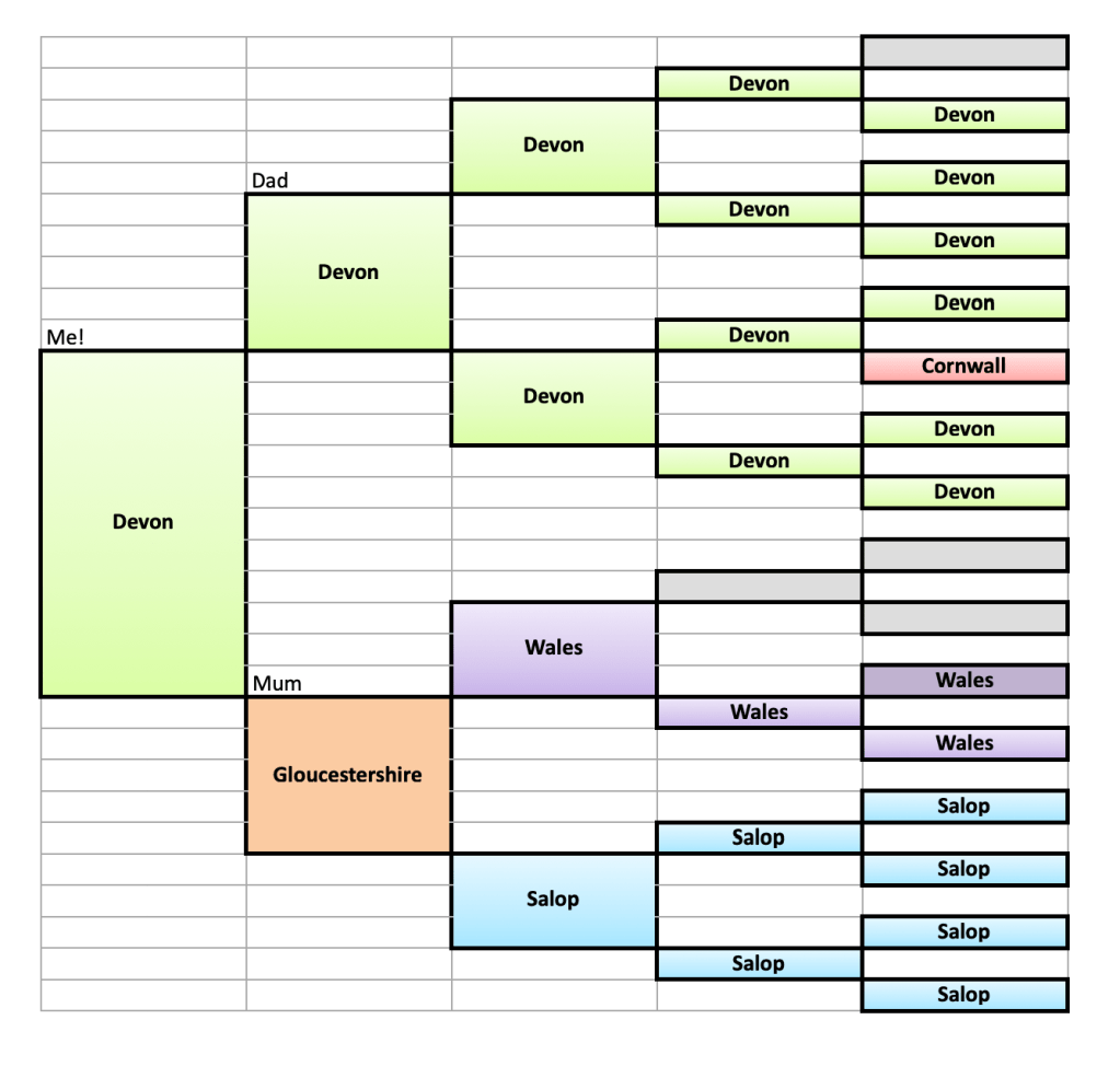
I was born in Okehampton (the nearest town) as was my father, but we lived in Sticklepath. All the other Devon ancestors except one were born in Sticklepath or in Sampford Courtenay Parish of which Sticklepath was a part.
Salop is the old name for Shropshire or Shrewsbury. My Welsh grandfather was born in Merionethshire and his mother and her parents were from Denbighshire. The grey boxes are unknown ancestors who I hope soon to investigate using DNA.
It makes a colourful image to add to our family history, but this analysis also helps us investigate those unknown ancestors. Considering the geography helps when trying to identify which ‘Sarah Jones’ is likely to be the right one – logical reasoning using a map can help make sense of our evidence.
Always bear in mind however there will be ‘oddities’ like my Mother, the only one born in Gloucestershire. Such individuals stand out clearly and that draws us in to investigate. Why did her parents move? And, especially for more ancient ancestors, how – by canal, sea, rail or road.
Many trains from Wales went through Shrewsbury (Seemap). This was where my Welsh grandfather moved, in order to work in Bradley’s gentleman’s outfitters. Relatively easy access to visit family back in Wales. There he met his Shropshire lass and they moved to work in Wotton-Under-Edge, Gloucestershire, where Mum was born, before buying a shop in Bristol. From there my mother went to University in Devon and never really left!
If only I was artistic I would draw a map showing the Welsh shopkeeper whose son went to Shrewsbury by train where he met his love in a hat shop, then moved to Bristol to work for the aerospace industry alongside running their own greengrocer’s shop. Their student daughter travelled from Bristol, again by train, to Exeter’s University, gaining her degree. She took bicycle trips and some walks on Dartmoor during courtship, then helped her new Devonian husband run a lorry business. They took pit props and steel to Wales, thus completing the circle! They also transported some of the construction materials for ‘British Steel’, the yacht in which Chay Blyth circumnavigated the globe ‘the wrong way’ in the 1970s.
What would your ancestral maps look like?
For more inspiration Google ‘illustrated maps’. For some great examples, see Tom Woolley who offers articles on how to create your own too.
I love to collect #oldpostcards and photos with any relationship to #Sticklepath, its people, places or events. Often the picture shows things in the background or fashion for example that add interest. In my view the best postcards have been posted. Of course the stamp and postmark can be of interest but messages can allow us a fascinating glimpse into past lives. For example:
“I just caught the train at Oke, it was moving when the guard opened the door for me, the other was so late from B. Love D. All Good Wishes”.
The postmark is Tavistock 24th December 1909. Had she been visiting relatives? Taking Christmas greetings and a pot of jam to family? Or attending a nephew’s nativity play perhaps? Can you imagine her running along the platform in her ankle length dress and buttoned boots, the steam billowing in the frosty air? Or could this message be from a man?
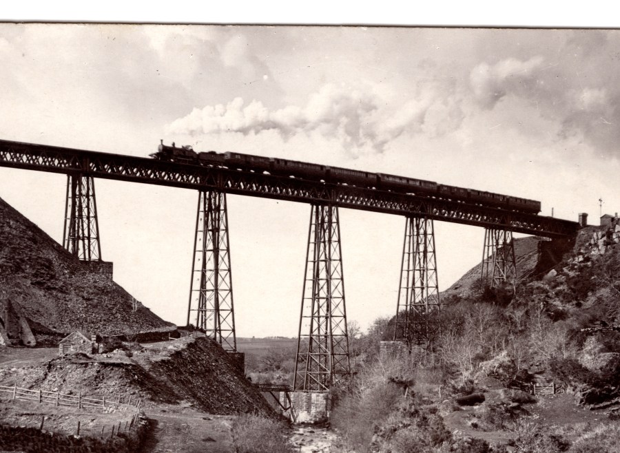
It seems our sender, D, had come from visiting the addressee, Miss Henning in Stratton. She would have caught the first train from Bude station to Okehampton and changed trains for the journey home to Tavistock. (The Bude line split from the main Plymouth line just after Meldon Viaduct, pictured above). Bude station opened in 1898 but very little evidence of the line or station remains today, being a victim of Dr Beechings cuts in 1966.
‘Oke’ or Okehampton Station, which opened in 1871, was similarly ‘cut’ and closed in 1971, but with the government ‘Restoring Your Railway’ initiative, services on the Dartmoor Line are expected to restart at some point in 2021 providing a regular, daily passenger rail service between Okehampton and Exeter.
As children we took a special train ride to Exeter before the line closed. I wonder how many people did that?
On 24th December 1927 Maria Palmer bought No. 2 Ska View Cottages Sticklepath. The previous owner, her father, Mr James Neill had died in February. Sadly his other daughter Beatrice had died in the interim. (Will dated 7 April 1927, she died on 26 May 1927). Frank Richards, her husband, was the sole Executor and Beatrice left her estate (which included a half share of No 2 Ska View) to her nephew Bernard William Palmer aged 13y, the son of Maria and John Palmer. The conveyance therefore became a little complex legally, with John Palmer representing the ‘infant’ son Bernard in the transaction.
Frank Richards was the headmaster of Sticklepath School and his wife’s death is noted in the school records, just to say that he took a half day because of her death!
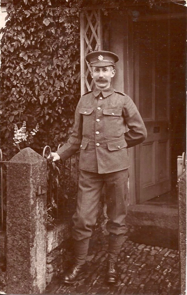
Frank Richards, WW1 uniform. Details seen of cobbled path, granite pillars and ‘trellis’ porch.
No.2 was valued by Mr Arthur John Powlesland of Okehampton, a duly qualified valuer, who fixed the price as £320. The current tenant was a Miss Cann.
I have at this time no evidence to suggest Maria Palmer ever lived in Ska View Cottages. She wrote her Will 12 June 1958. Her son Bernard became a Chartered Accountant, and at the time of Maria’s death lived at 22 Mill Lane Felixstowe, Suffolk. Maria was said to be of the same address and formerly of ‘Kolar’ Okehampton. Maria died at The East Suffolk Hospital, Ipswich on 24th October 1958. She left everything to her son, Probate was granted in Exeter to him 9th January 1959. Assent to the vesting of Number 2 Ska View Cottages from Mrs M Palmer deceased to Bernard William Palmer is dated 22nd April 1959.
At some point Bernard moved to 19 Goyfield Avenue, Felixstowe. 11 December 1959 the cottage was sold again to Mr Charles Bowden, haulage contractor of Cleave House Sticklepath for £550. Witness to the signature was RK Barron of Foundry House Sticklepath, Tool Maker. In March 1965 a further valuation, by Anthony Wonnacott, likely for re-mortgaging purposes shows the property to be valued at £1,500.
A Memorandum appended to the conveyance shows that 26th October 1992 Charles Bowden gave the garden by Deed of Gift to Charles Roger Finch Bowden (his son) in fee simple. Charles died 20 March 1994 and Probate was granted (Bristol) 16 Nov 1995. The property assented to Charles Roger Finch Bowden and his wife Ann Rosalie Lloyd Bowden 28 January 1997. Land Registry Official Copy of Register of Title in 2008 valuation was £140,000 (without the detached garden). The type of joint ownership was amended 12 Dec 2012. Marketing websites show it sold in 2018 for £150,000.
In 1975 plans were submitted to make an interconnecting doorway between No.1 and No.2 Ska View Cottages. At that time Miss Phyllis Finch lived in No. 2 and the doorway and firecheck door enabled her to visit her sister in No.1 without venturing outdoors in the final weeks of her life. Planning was approved 17 October 1975. She died in March 1976. The doorway has since been blocked up.
I have not included much detail of the owners themselves, and even less of other occupiers. Perhaps another time. I am also aware that there may be other connections – I spent many hours in the Ska View Cottages as a child, visiting relatives or with my ‘child-minder’ after school, which is of course not documented. Nor do the papers survive to tell us how the houses were financed, how much mortgage was payable. I do not have any insurance documents for No. 2. ‘Official searches’ in 1959 do not add anything specific. Several documents declare no land tax was payable on these small properties.
It is interesting to see the increasing valuation or sale prices:
1890. £100. Sale
1924. £380 Sale
1927. £320 Valuation/Assent
1959. £550 Sale
1965. £1,500 Valuation
2008. £140,000. Valuation
2018. £150,000 Sale
One might surmise that the assent value in 1927 was on the low side but market fluctuations may mean it was accurate, and there was a tenant in situ.
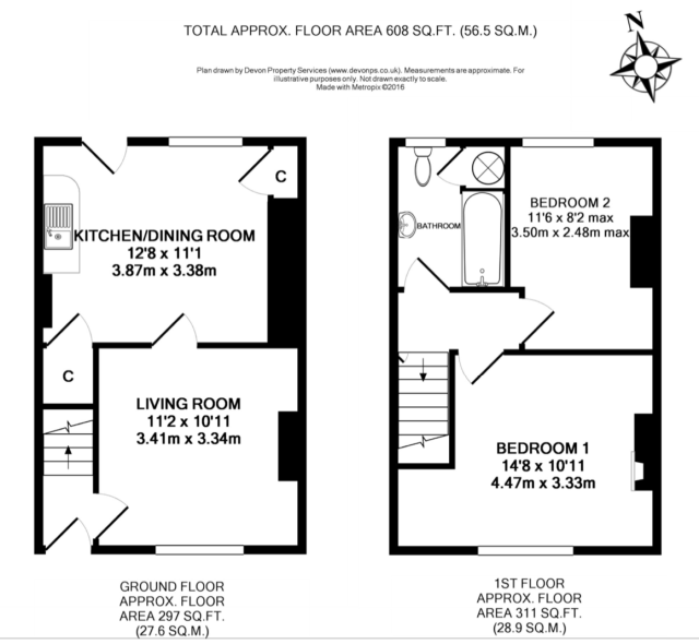
Perhaps equally interesting is to understand the size and type of housing of a headmaster and mine manager in the 1920s, perhaps some of the better off villagers, with a total floor area of 56.5 sq m . The plan prepared for Stags estate agent Okehampton 2017 shows there were two downstairs rooms and two upstairs.
There was no bathroom in their time. It is not clear when a bathroom was added to No. 2, planning was sought for indoor bathrooms in other cottages in 1972. The outdoor toilet across the yard was certainly in regular use in 1960s. They did not have covered sewerage or electiricity, so no electrical appliances. (Details of how the drains were ‘flushed ‘ see Ladywell).
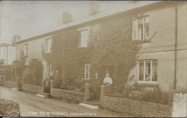
The open drain can be seen just infront of the wall with a step from each Cottage bridging the gap. (Chapman of Dawlish Postcard)
The detached garden was a small allotment used to grow vegetables, a necessity not a hobby. Compare that to expectations of families today both in terms of space, amenities and services.
The row of 4 Ska View Cottages with stone outbuildings behind. The Old Cottage and Village Hall are seen to the right. Between these two the Back Lane leads to the electricity sub-station (black)and just past this, off the picture would be the garden allotment.
Tiled roof and chimney detail No.1 and No.2
Sticklepath has several small terraces of houses running parallel to the road. The cottages are well built of solid masonary. Originally they had a shared roof space – as with many old rural houses this has provided a roost for bats (myotis sp.).
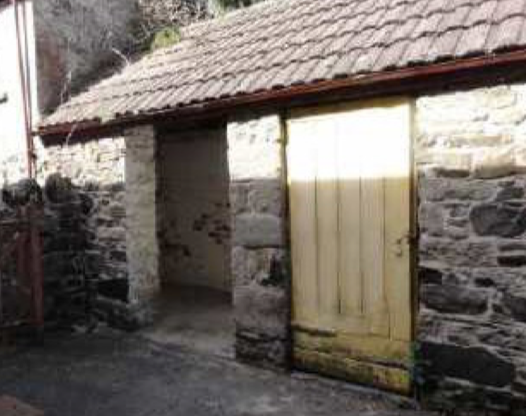
Stone built out-house believed to have stabled a pony at one time. Later W.C.(water closet or toilet)
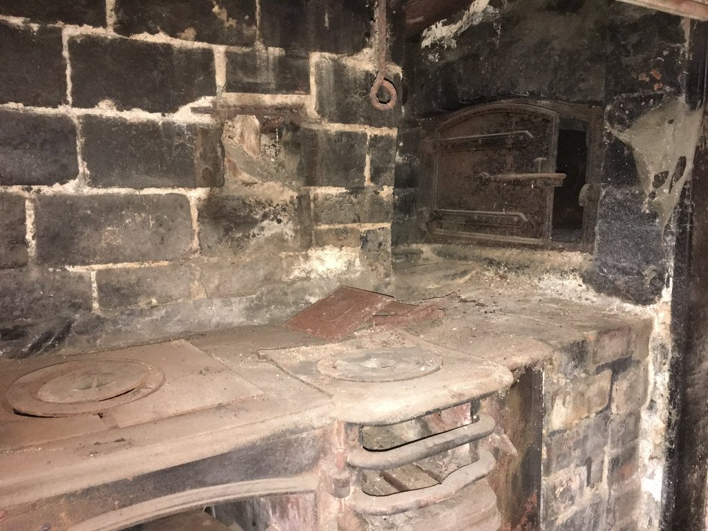
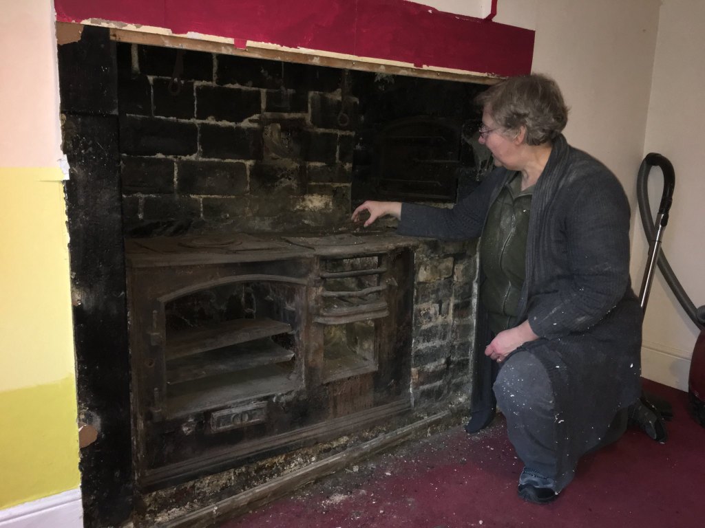
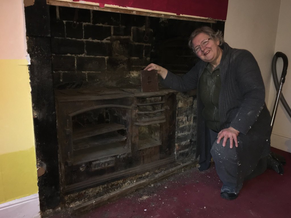
During renovation work in 2017 a small Victorian range was found in No. 2 kitchen. The plaque above suggests it was made or at least sold by an Okehampton firm. It was in a poor state and Okehampton Museum were not interested in preserving the remains. It seems very likely Captain Neill and his family would have benefitted from food cooked in such an oven, on the hob, a fire in the grate and bread from the bread oven. A family with these facilities may have made extra to sell to other villagers.
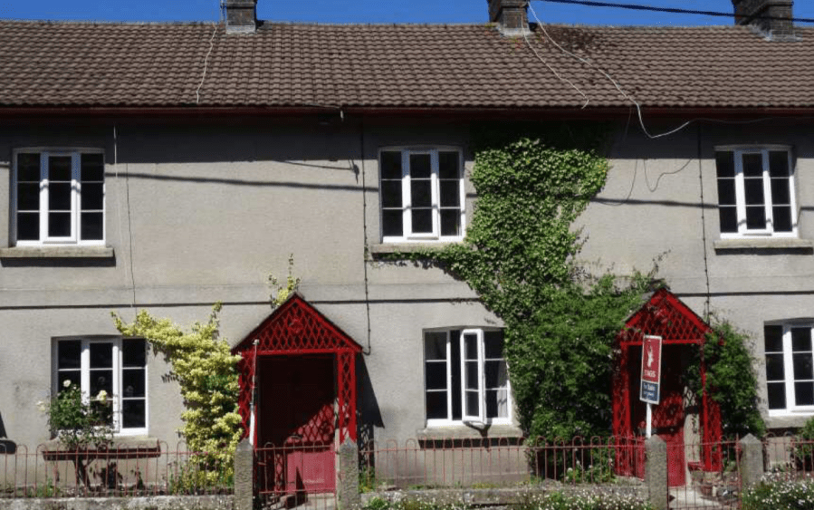
Times change and No.2 is now a holiday cottage, no longer accomodation for local residents. The railings and matching porches (also seem on Farley Cottage and previously on Effra, opposite the Methodist Chapel) give some character and unity to this row of cottages.


