
If you asked people to come up with landmarks in England, Salisbury Plain’s Stonehenge would not be far from the top of the list. There is something mystical about megaliths that attracts our eye and a tactile quality about their solidity, calling us to reach out on a grey blustery day to touch their un-forgiving heat-absorbing surface. On sunny days, they willingly sharing their warmth with us as we eagerly explore the crevices and uneven textures of their surface. Sadly one can no longer explore Stonehenge as we did in childhood, coming up close to appreciate their size and impact.
Dartmoor provides many examples of granite landmarks – stone circles or lines, remains of ancient huts to intrigue the hiker, stone walls, and, of course, the Tors. I love the shapes made through weathering and lichens on the surface, adding character and apparent antiquity. Folklore surrounds many formations – the Tolmen stone (celtic for hole – stone) is said to have been used in Druid purification ceremonies and later thought to have the power to cure rheumatic disorders – if you were able to pass through the the hole the requisite number of times.
Celtic for Long Stone is maen hir. There are about 12 generally recognised genuine Menhir long stones remaining on Dartmoor but only 3 still standing, guarding the hill tops, stone beacons visible for miles around up to 3.5 or even 4.2m tall. Landmarks which guide walkers on their way but perhaps drew ancients to worship, pointing to the wonders of creation. A few of the largest have been dated to show they do originate in the bronze age, 4,500 years ago.
Some of the less grand Menhirs are the only remaining post in a row or structure, where smaller stones were likely removed for wall or house building elsewhere. Others are thought to have marked Medieval cross roads or tracks. They may have marked meeting places, perhaps for marketing goods, or been boundary markers of some sort. In our neighbouring village South Zeal, the Oxenham Arms was built around a large menhir. Others indicate ancient burial places, much as the gravestones of today, a memorial to the people or time, lest we forget.
All these Menhirs, crosses and boundary stones have been well documented by historians such as William Crossing, Rev Sabine Baring Gould, W.G. Hoskins and D.J.L Brewer as well as our own St Leger Gordons, many academics from Exeter University and others.

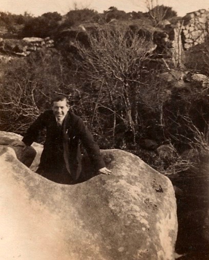
Sticklepath can not claim one of the giants, but we have our own ancient granite Menhirs which have attracted attention, speculation and stories: the Honest Man and the Incised Stone. These have been re-purposed over the years, likely St Andrew’s crosses added to Christianise them and more recent use as Parish boundary markers, first between Belstone and Sampford Courtenay and now Sticklepath Parish. Much has been written, often with great consternation, of the orientation and exact position of the stones. There has been natural sinking, and of necessity movement for road widening or for preservation of the stones. Both are about 6 feet tall but most often 3-4 feet of granite is visible.
The Honest Man, of similar appearance, has two stories associated with it, documented by Ruth St Leger-Gordon of sticklepath (St. Ledger-Gordon, 1972, The Witchcraft and Folklore of Dartmoor, EP Publishing, Wakefield). Firstly a ‘Good Samaritan’ story suggests it was erected by a man who had been assaulted as a memorial to his rescuer’s kindness. The second reminds us that the stone marks the Mariner’s Way, the route taken by sailors across the county when changing ships. It tells of one coming up the hill from the Inns of Sticklepath, rather the worse for ale, probably in the semi-dark, mistaking the stone for a person and asking “Be ye an honest man?”
St Leger-Gordon also speculates that it may once have been a signpost for the meeting of a pagan religious group. Page describing the stone slightly earlier doesn’t mention the name ‘Honest man’, which is likely therefore to have been a more recent innovation (Page, J. Ll. W. 1895 The Exploration of Dartmoor, Seeley & Co. London). The best photo I have found showing some markings is at https://www.legendarydartmoor.co.uk/honestman.htm
From the Honest Man at the entrance to Bude farm, for 300 yards the Mariner’s way is also the Parish boundary. Beating the Bounds, a strong local tradition still occurs perhaps every 7 years, Covid allowing!
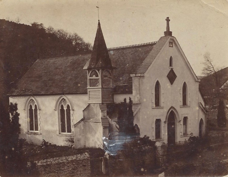
Sticklepath also boasts an ancient granite cross, of medieval style. This is found on top of the Wesleyan Chapel which was built in 1816. The origins of the cross are lost in the mists of time.
For more about Dartmoor’s Long Stones: https://www.legendarydartmoor.co.uk/gran_sent.htm
Sticklepath Heritage Group has done research on the standing stones and may have further information available.
COMING SOON… #OnePlaceTragedies
The One-place Studies Society invites anyone with an interest in local history or family history or house history to join us with monthly blog prompts throughout 2021
https://www.one-place-studies.org/one-place-study-blogging-prompts-2021-everyones-invited/
One Place Studies can be found throughout the world – Sue Wyatt in Tasmania has a message encouraging her readers to contribute too – READERS: DO YOU HAVE ANY OTHER IDEAS FOR POSTS? – it would be great if anyone with an interest in Sticklepath would like to join in… let me know if you don’t have a blog or website, I can help with that! No need to stick to the suggested topics, but please let me know so I can flag it up here too.
- January – Landmarks
- February – Tragedies
- March – Women
- April – Pubs and other drinking establishments
- May – Worship
- June – Maps

Pingback: More #OnePlaceLandmarks blog posts - Society for One-Place Studies
Pingback: Ramblings on #OnePlaceEnvironment – #Sticklepath – Sticklepath a Village and its People